


GEO and Google Earth Engine announce funding for 32 projects to improve our planet
News / 13 July 2020

Today, The Group on Earth Observations (GEO) and Google Earth Engine (GEE) have announced 32 projects from 22 countries that will be awarded $3 million USD towards production licenses and $1 million in technical support from EO Data Science to tackle some of the world’s greatest challenges using open Earth data. The GEO-GEE Programme is also supporting projects with the United Nations Environment Programme (UNEP) and the United Nations Economic and Social Commission for Western Asia (UNESCWA) to use Google Earth Engine to support climate change and disaster monitoring activities over the next two years.
“Impact begins with insights. Organizations globally are using Google Earth Engine to achieve an unprecedented understanding of our changing environment and turn data into action,” said Rebecca Moore, director of Google Earth, Earth Engine & Outreach “We are honored that Google Earth Engine can support the people behind these 32 winning projects as they tackle pressing global issues, from forest degradation and flood monitoring, to natural resource management and global climate change.”
Last year, GEO and Google Earth Engine announced a call to action for Earth observations projects monitoring the pulse of the planet to apply for the GEO-GEE Programme. More than 50 projects were submitted from around the globe on a range of social and environmental topics including climate monitoring, water and coastal observations, sustainable development and other key areas related to environmental protection and conservation. Today the winning proposals begin a two-year journey to produce tangible societal benefits using the power of Earth observations coupled to Google Earth Engine. In partnership with EO Data Science, the winners are receiving in-kind technical support, mentoring and ongoing capacity development to ensure projects achieve their intended impact.
Through a careful review process, the GEO-GEE programme has selected proposals from organizations and initiatives that will deliver significant impact using Earth observations and data science with respect to improved decision making. Projects with direct relevance to global policy agendas including the Sendai Framework for Disaster Risk Reduction, the Paris Agreement on Climate Change, the United Nations 2030 Agenda for Sustainable Development, as well as ocean conservation and biodiversity preservation were encouraged and considered essential elements of the proposals.
The winning projects are responding to a wide range of environmental and social challenges using real-time Earth observation data coupled with cloud computing, some of which include: mapping poverty data and vulnerable settlements, deforestation and land degradation, flood warnings, marine coasts, ice shelf monitoring, environment and climate stress, food and agriculture and many more.
“GEO is very proud to be supporting these projects in collaboration with Google Earth Engine and EO Data Science. I am thoroughly impressed with the number, quality and the diversity of proposals we received. The diversity in terms of the topics, regions and approaches is a testament to the fact the Earth observations are instrumental for a wide range of applications and solutions,” said Gilberto Camara, GEO Secretariat Director. “The results of these projects will help GEO fulfil our mission globally to improve decision making with EO data. Several of the winning solutions are focused on GEO’s priorities around Climate Change, Disaster Risk Reduction and Sustainable Development. We look forward to their evolution and the open solutions they produce,” Camara explained.
GEO is an Intergovernmental Partnership of 111 countries and coordinates over 60 global activities in the GEO Work Programme. GEO’s mission is to inform decision making and enable better policies through open Earth observation data, information and knowledge. The GEO network will ensure that the beneficiaries receive support as they deliver data, insights and key findings to reach critical decision makers across the globe.
The GEO-GEE programme is carried out in cooperation with the GEO Secretariat, GEO Programme Board, Google and EO Data Science. Google is providing production licenses to use GEE and EO Data Science is providing ongoing technical support, mentoring and capacity development support through a targeted outreach programme.
“Our team is looking forward to supporting the successful projects over the next two years. We were very impressed with the quality of applications, particularly the potential they have to enact positive change and significantly impact global challenges through the use of Earth Observations,” said Nathan Eaton, Executive Director at EO Data Science.
Open Data for Better Decisions
Open data is instrumental in providing the necessary insights for assessing the constant changes happening on our planet. With these insights, decision makers can take the critical actions possible to address urgent environmental challenges. Using open data in a sustained production environment, these projects will make their findings openly available for decision makers.
Google Earth Engine combines a multi-petabyte catalog of satellite imagery and geospatial datasets with planetary-scale analysis capabilities and makes it available for scientists, researchers, and developers to detect changes, map trends, and quantify differences on the Earth's surface. With access to the Google Earth Engine, researchers and organizations can better map, measure and monitor our changing planet with decision-relevant geographical data.
Winning Projects
The GEO-GEE Programme will launch an outreach and communications campaign led by EO Data Science which will feature the winning projects in a dedicated blog series over the next year, highlighting the teams, their approach and outcomes. Through effective science communication, this campaign will raise the profile of a wide range of researchers and policy makers through this programme. Discover the winning projects and hear from some of the awarded projects below.
Discover the full list of winning projects:
|
Project |
Submitting Organization(s) |
Country
|
|
Paddy Watch |
Sydney Institute of Agriculture, The University of Sydney |
Australia |
|
Remap |
College of Science and Engineering, James Cook University |
Australia |
|
Alert System for Algal Bloom |
Federal University of Pelotas, Brazil (UFPel) |
Brazil |
|
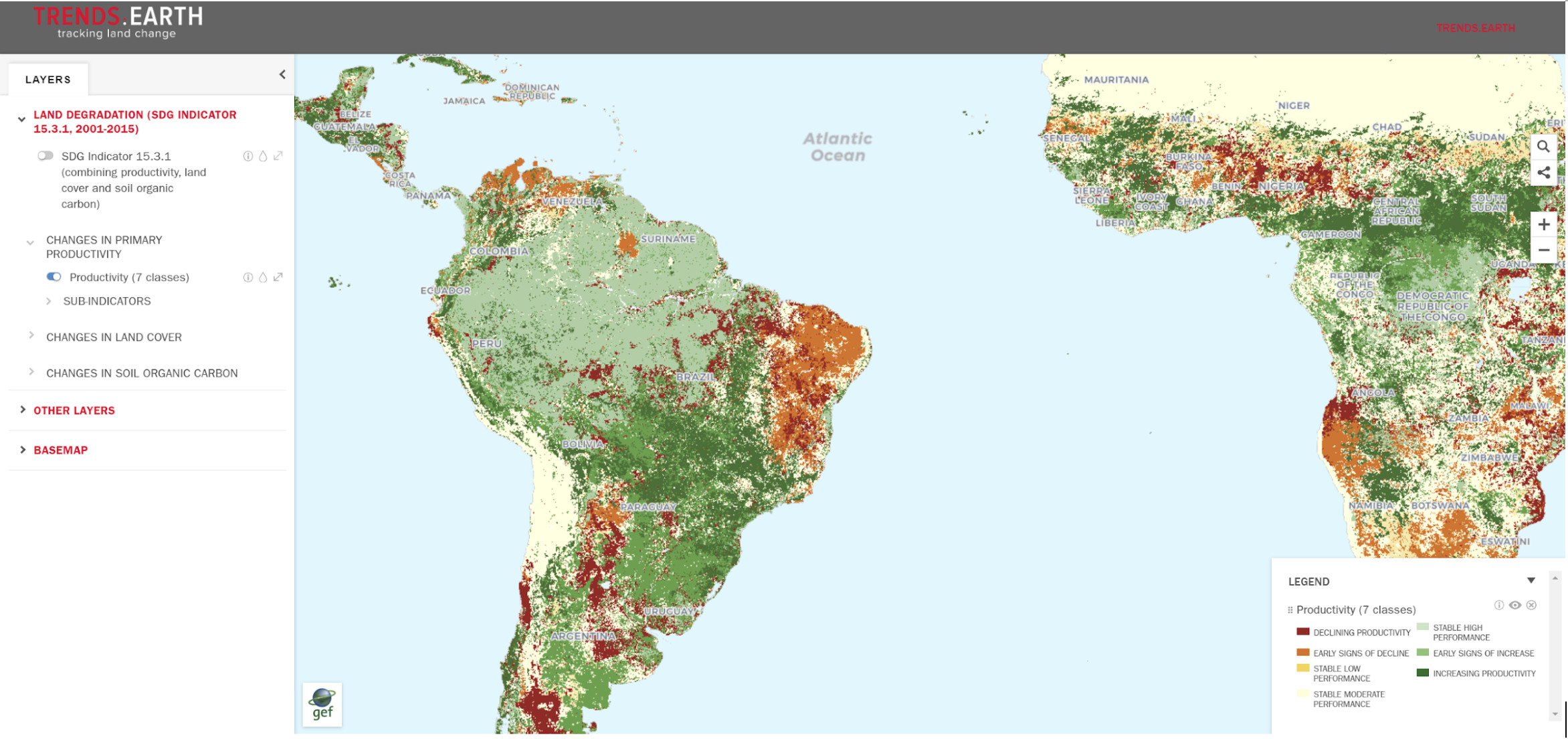
Land Degradation Neutrality |
Institute of Remote Sensing and Digital Earth, Chinese Academy of Sciences |
China |
|
BioModelos |
Instituto Alexander von Humboldt |
Colombia |
|
Multi-temporal Change Detection |
Profesional Especializado GIT. Administración de la información geodésica, cartográfica y geográfica. Instituto Geográfico Agustín Codazzi - IGAC |
Colombia |
|
Coastal Erosion and Mangrove Ecosystems |
Institute of Marine and Coastal Research |
Colombia |
|
Ecological Integrity Index |
Humboldt Institute, National Parks office, Conservation International, and The Nature Conservancy in Colombia |
Colombia |
|
Deforestation / Forest Degradation |
National Center for Geoenvironmental Information (CENIGA) of the Ministry of Environment and Energy (MINAE) of Costa Rica |
Costa Rica |
|
Identification of Vulnerable Areas and / or Climatic Risks |
Ministerio del Ambiente (Ecuadorian Ministry of Environment) |
Ecuador |
|
Urban Agricultural Intensity with SAR and optical RS |
Faculty of Hydraulic and Water Resources Engineering, Institute of Water Technology, Arba Minch University |
Ethiopia |
|
Analysis Ready Data for Water Security |
Pacific Community (SPC), Australian National University (ANU) |
Fiji |
|
Coastal Ecosystems |
German Aerospace Center (DLR) |
Germany |
|
Marine Coastal Eutrophication |
Institute for Space-Earth Environmental Research, Nagoya University
|
Japan |
|
Natural Resources Management |
Kenya Space Agency
|
Kenya |
|
Ice Shelf Monitoring |
Department of Geoscience & Remote Sensing Delft University of Technology |
Netherlands |
|
i) Multi-scale Flood Monitoring and Assessment Services for West Africa (MiFMASS) ii) UK Space Agency – International Partnership Programme: Strengthening Public Policy from Space (SPPS): Satellite-enabled Data Services |
African Regional Centre for Space Science & Technology Education-English |
Nigeria |
|
Flood Monitoring |
Institute and Observatory of Geophysics, Antananarivo (IOGA). University of Antananarivo |
Madagascar |
|
Large-Scale High-Resolution Detection of Vulnerable Settlements |
National Institute of Statistics and Geography (INEGI, Mexico) |
Mexico |
|
Fire Danger Warning System |
Eversis |
Poland |
|
Sustainable water management for agriculture |
Laboratoire de Télédétection Appliquée (LTA) and Centre de Suivi Ecologique (CSE) |
Senegal |
|
Vegetation monitoring - Cape Floristic Region |
South African Environmental Observation Network (SAEON), Fynbos Node |
South Africa |
|
Multidimensional Poverty Data - Africa |
Department of Sociology and Work Science, University of Gothenburg and Center for Population and Development Studies, Harvard University. |
Sweden/USA |
|
Global environmental change monitoring |
KTH Royal Institute of Technology Director, Division of Geoinformatics Department of Urban Planning & Environment |
Sweden |
|
Sustainable Water Management |
Observatoire du Sahara et du Sahel (OSS) |
Tunisia |
|
Deep Learning Methods for Land Cover and Land Use Classification |
Space Research Institute NAS Ukraine and SSA Ukraine |
Ukraine |
|
Essential Biodiversity Variables - ScaleUp |
University of Florida and Florida Museum of Natural History and German Centre for Integrative Biodiversity Research (iDiv) |
USA/Germany |
|
AquaWatch |
University of Wisconsin-Madison Space Science and Engineering |
USA |
|
Trends.Earth - Supporting Land Degradation Neutrality |
Ecosystem Analysis Moore Center for Science, Conservation International
|
USA |
|
Ecological Integrity Index |
Northern Arizona University SICCS
|
USA |
|
Disaster Forecasting, Mitigation, Response |
ImageCat, Inc |
USA |
|
Monitoring Disasters Impacts on Land Cover in Coastal Zones of Egypt |
United Nations Economic and Social Commission for Western Asia |
UNESCWA |
|
Environment and Climate Stress Index |
UN Environment Programme |
UNEP |
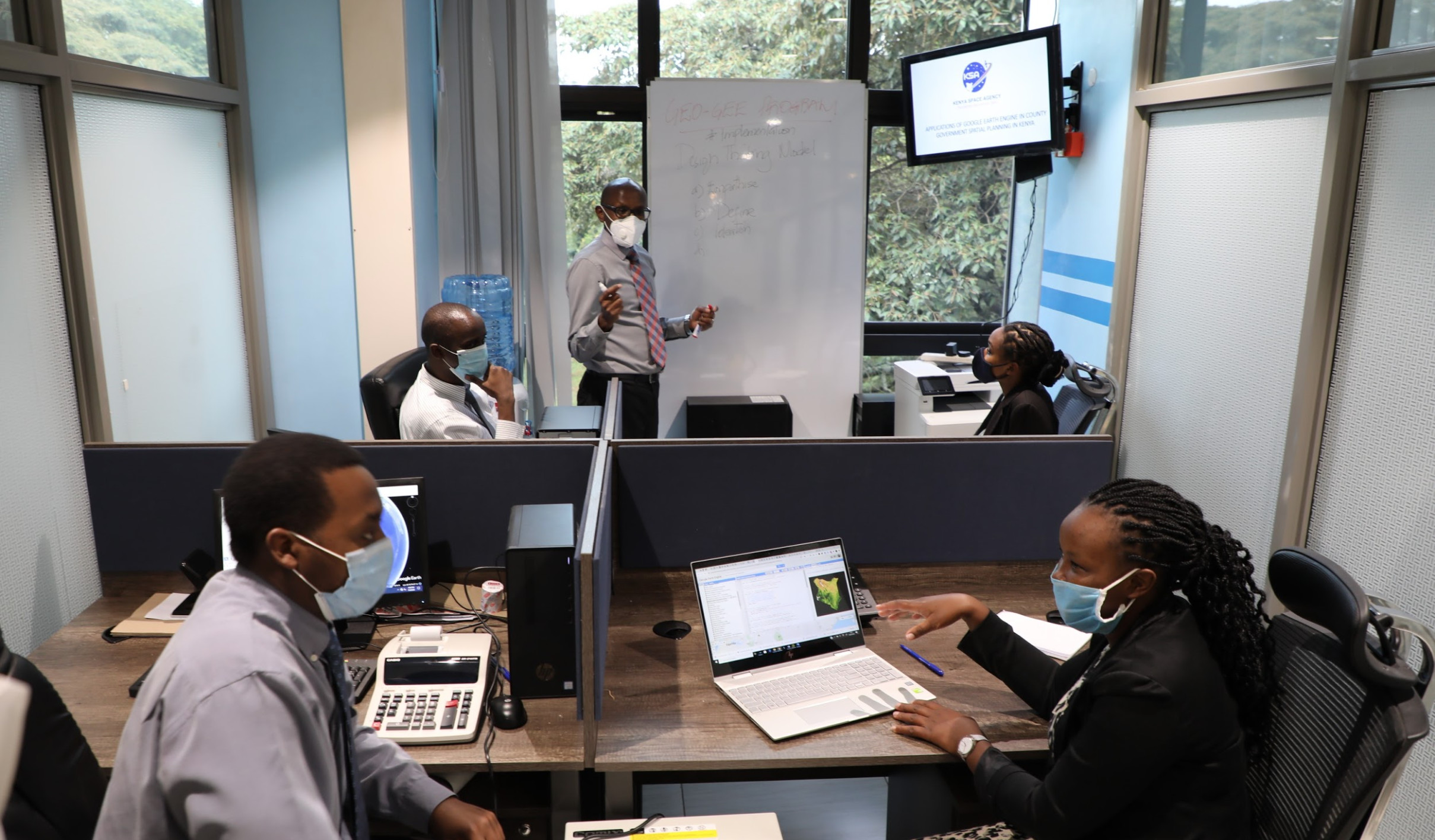
“We are honored for having been selected to benefit from the GEO-GEE unlimited license programme. This opportunity offers the Kenya Space Agency a platform to support the County Governments in Kenya to develop Earth Observation products and build their capacity on the adoption and utilization of space-derived data in decision making.”
Maj. Gen. Thomas Chepkuto, Ag. Director General, Kenya Space Agency.

“We are excited to be part of the GEO-GEE programme as its technical support and global communication channels will empower our ability to strengthen national-scale efforts towards: effective and nature-based climate change mitigation and adaptation, solid and data-driven global carbon budgeting; and more efficient sustainable development schemes and strategies"
Dr. Dimos Traganos, Project Manager of the Global Seagrass Watch project.
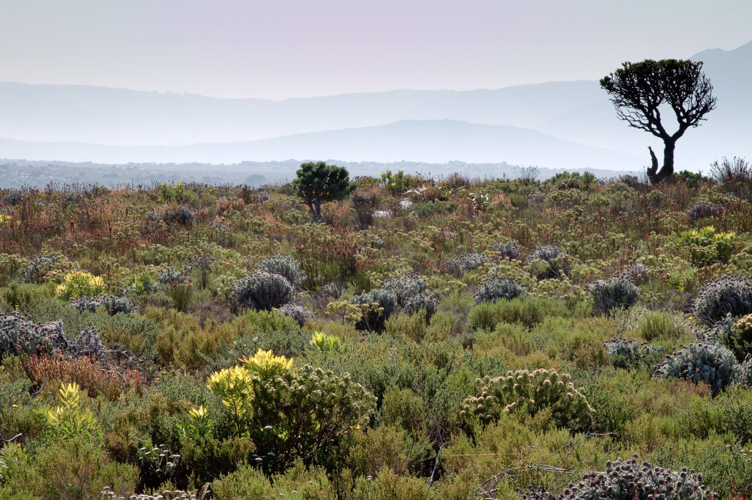
"We aim to develop a tool to monitor the health of fynbos vegetation across its entire range using freely available satellite data and the processing power of Google Earth Engine. Our algorithms will forecast the natural postfire recovery trajectory of healthy vegetation and be used to diagnose anomalous signals that may be an early warning signal of habitat degradation. This early warning system will aid land managers and conservation authorities, allowing them to monitor the health of vegetation that would otherwise seldom be visited, and prioritise areas for intervention."
Dr Glenn Moncrieff, Data Scientist, Fynbos Node, South African Environmental Observation Network (SAEON).

“It is great to hear that our project is accepted for the GEO-GEE License Programme. We are excited to develop a real-time monitoring tool for eutrophication assessment on a global scale using the power of Google Earth Engine. We believe that our methodology is useful to track the progress against Sustainable Development Goals target 14.1 that try to prevent and significantly reduce marine pollution particularly from land-based activities.”
Prof. Joji Ishizaka (Ph.D), Institute for Space-Earth Environmental Research (ISEE), Nagoya University.
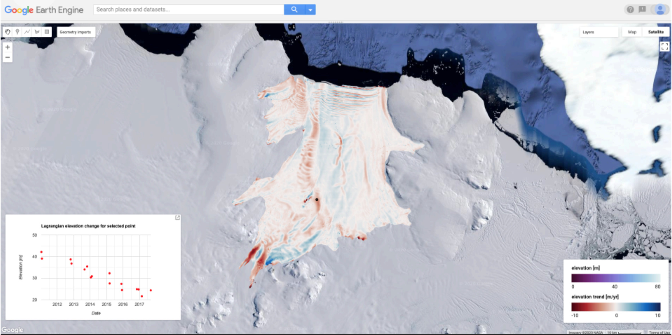
“With this project we want to build a platform to analyse and demonstrate the use of satellite data over Antarctic ice shelves. This will allow insight in the surface, subsurface and basal conditions of these ice shelves, which are major sources of uncertainty in future sea level projections from Antarctica.”
Stef Lhermitte, Assistant Professor, Delft University of Technology.
“We are very excited about the GEO-GEE project as it will complement the HiRISE consortium, which was recently funded by the Dutch Research Council (NWO), with a GEE-data interface for providing easily accessible satellite and model products on ice shelf status over all Antarctic ice shelves for the broader cryosphere/ocean/sea level rise community and the wider public.”
Bert Wouters, Assistant Professor Delft University of Technology/Utrecht University.
“As the Geographic Institute Agustín Codazzi, we thank GEE for having selected our project ‘Multitemporal studies for the detection of changes’ as part of the GEO-Google Earth Engine (GEE) Program to be developed in the next two years. We are sure that this participation will allow us to enhance our capacities for handling, analyzing and disseminating the raster information that our entity has, for the benefit of the country's development.”
Sandra Milena Ortegón, Profesional Especializado GIT. Administración de la información geodésica, cartográfica y geográfica. Instituto Geográfico Agustín Codazzi - IGAC

“When successfully implemented, this action will provide tools, models, databases and systems that will enhance the information and knowledge base of the respective Disaster Monitoring Organisations (DMOs) across West Africa and subsequently reduce the enormity of losses that are normally associated with floods. Through tailor made trainings, the action will positively impact on the technical expertise of these organizations to manage, maintain and expand the developed systems. Derivation of flood risk maps and identification of floodplains will assist in putting in place measures or policies that will prevent the development of flood hotspots into settlements. We are excited to have this opportunity and hope to make impact by engaging the GEE technologies, and compute services, to generate products through the various available Application Programming Interface (APIs).”
Ganiyu Ishola Agbaje, African Regional Centre for Space Science & Technology Education-English (ARCSSTE-E).
"ImageCat is working on a NASA project with CIESIN and HOTOSM to find where regional risk from critical-infrastructure disruption stands to result in the type of cascading economic impacts that significantly reverse progress in developing countries. Working with GEE will enable the team to increase productivity substantially. We look forward to coordinating closely with GEO Work Program’s activities such as GEO-DARMA, EO4SDG, GUOI, and the Human-Planet project to advance SDG objectives."
Charles K. Huyck, Executive Vice President, ImageCat, Inc.
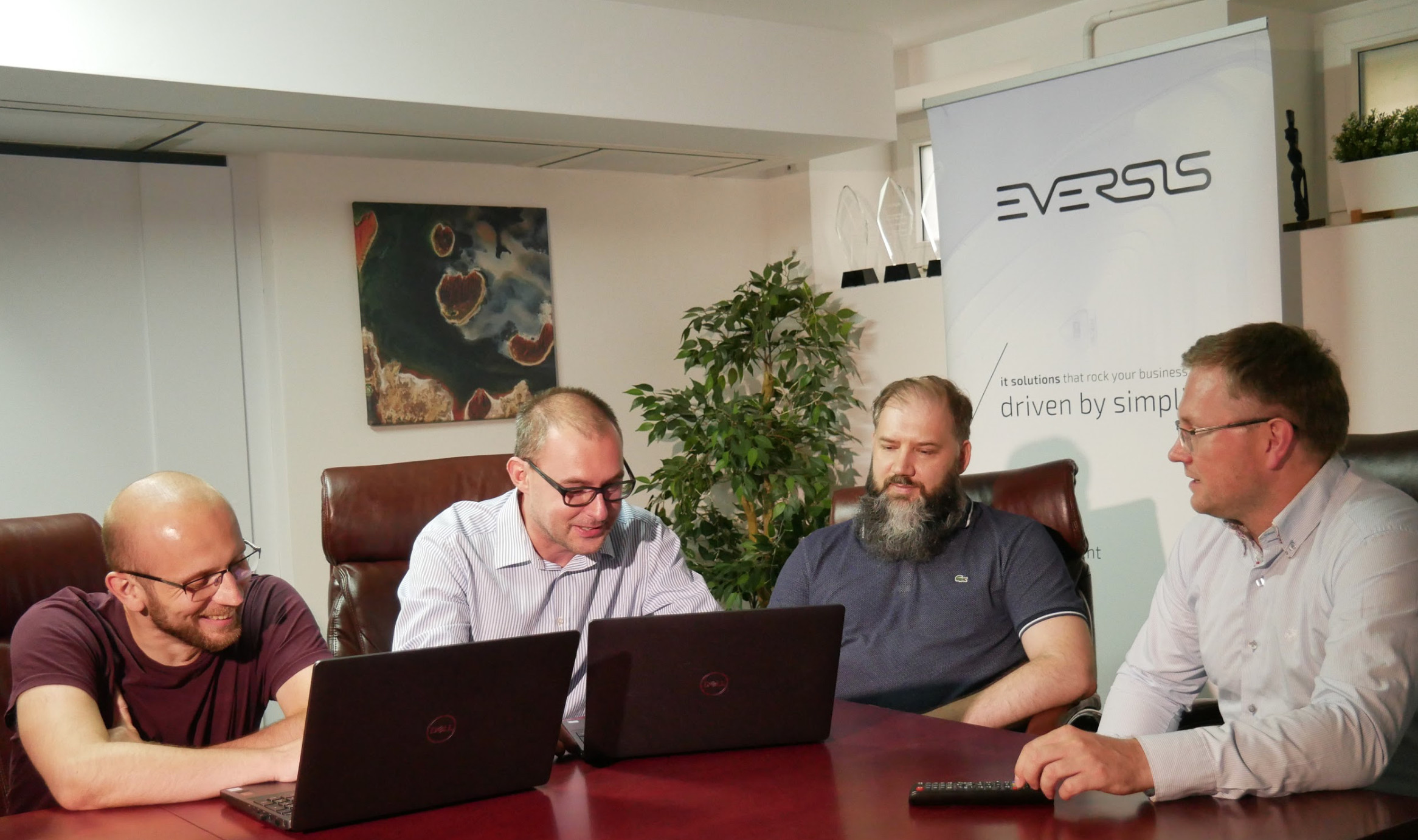
“We're very excited to have been selected to work on the Fire Hazard Warning System project and build on our experience with GEE technology. We hope that this System will fill in some gaps in the accurate risk reduction predictions and communication. We believe it will help us better understand natural phenomena, their causes and nature, which is crucial at the time when our natural environment changes so quickly and unpredictably. We are glad we can contribute to the application of science in creating a safer world for all of us.”
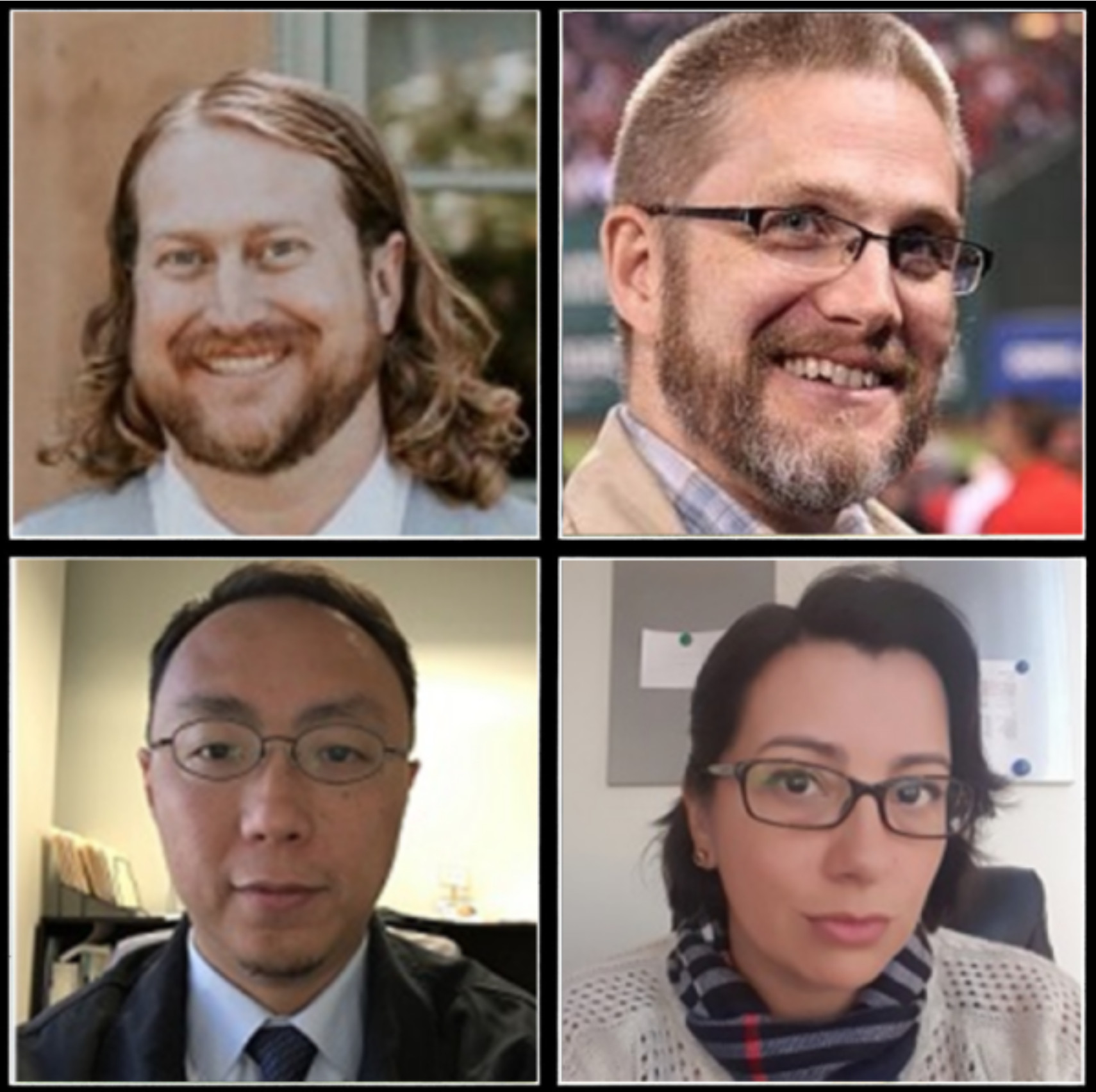
Piotr Zaborowski, Business Development Manager at Eversis.

The Environmental and Climate Stress Index is a collaborative project by the United Nations Environment Programme, University of Edinburgh and Earth Blox.
“This stimulating initiative to build a digital platform will substantially help the UN to reduce climate risks in the field. By mapping environmental stresses, the Environmental and Climate Stress Index (ECSI) will be crucial to promote sustainable livelihoods through more informed decision-making at the policy and programme levels.”
Albert Martinez, Climate Change Security Analyst, UNEP.
Read more quotes from the project team here

“Egypt has a special status with regards to climate change (extreme weather events from droughts, storms, floods, heat waves to sea level rise on coastal zones. This affects and damages agricultural areas and other land cover types and infrastructure. This project with UNESCWA will provide insights into areas at risk and damage estimation using official statistics in CAPMAS with new data sources using geospatial tools to help Egypt monitor and report on SDGs and most importantly for the Sustainable Development Strategy (SDS) ‘Egypt vision 2030’.”
Eng. Nahla Seddik Mohamed, General Director, IT Sector, CAPMAS, Egypt.

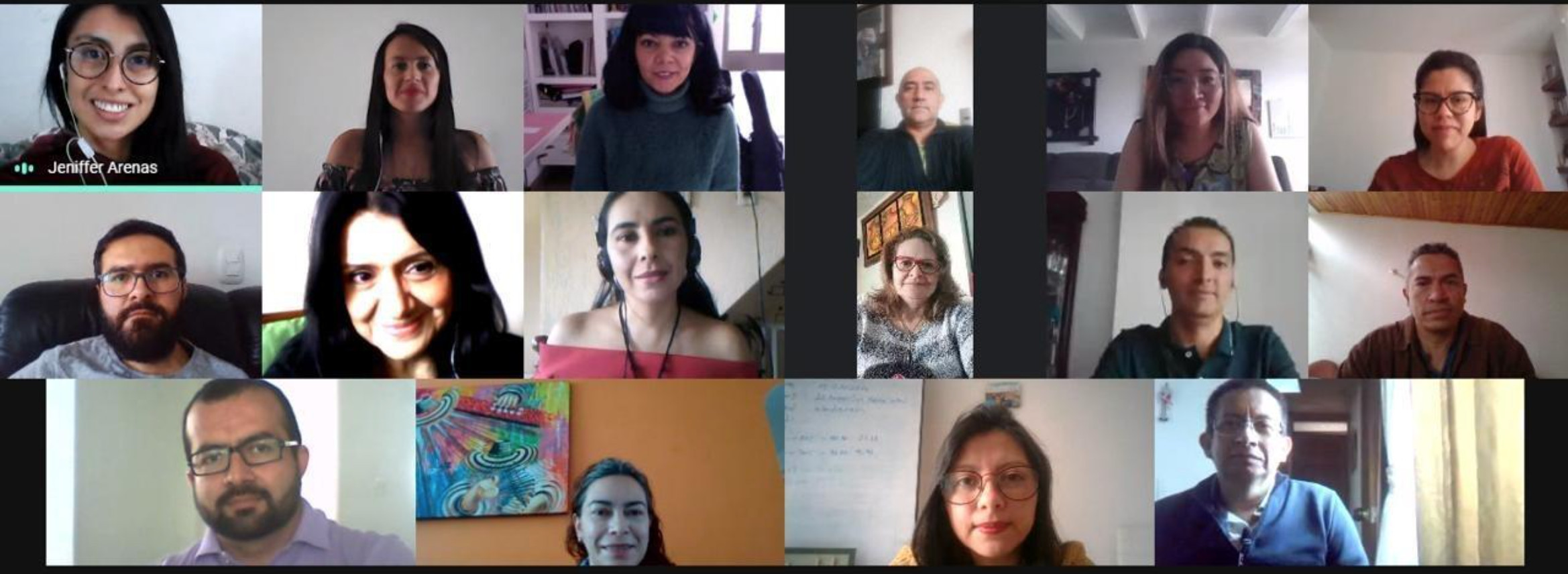
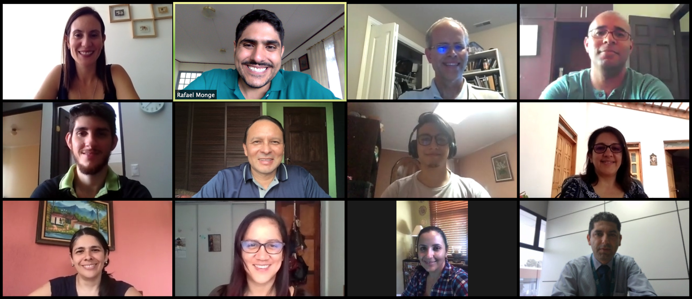
“Geospatial technology offers locational analysis possibilities, when linked to national official data, it allows us to observe and analyze landscape boundaries, trends and patterns in population distribution and economic activities, environmental conditions and natural resources allocations. Google Earth Engine is a valuable tool that transforms the way we assist member countries, and how we share experience and tools, from Brazil to Egypt, from USA to Bahrain. Our Google Earth Engine initiative for Monitoring Disasters Impacts on Land Cover in Coastal Zones of Egypt, where most people live and cultivate their lands, provides with the opportunity to learn from past events effects to be better prepared to mitigate risks to food security and biodiversity loss.”
Wafa Aboul Hosn, Chief of Economic and Environment Statistics at UNESCWA, and team members - see photo above.

“Our planet is facing unprecedented environmental challenges. This project ‘EO-AI4GlobalChange’ aims to develop innovative, robust and globally applicable methods, based on Earth observation big data and AI, for global environmental change monitoring focusing on urbanization and wildfire monitoring. The GEO-GEE license program provides very much needed cloud-based platform and credits for developing AI-based change detection algorithms exploiting EO time series at local, regional and global scale.”
Yifang Ban, Professor and Director of Geoinformatics Division at KTH Royal Institute of Technology in Stockholm, Sweden.
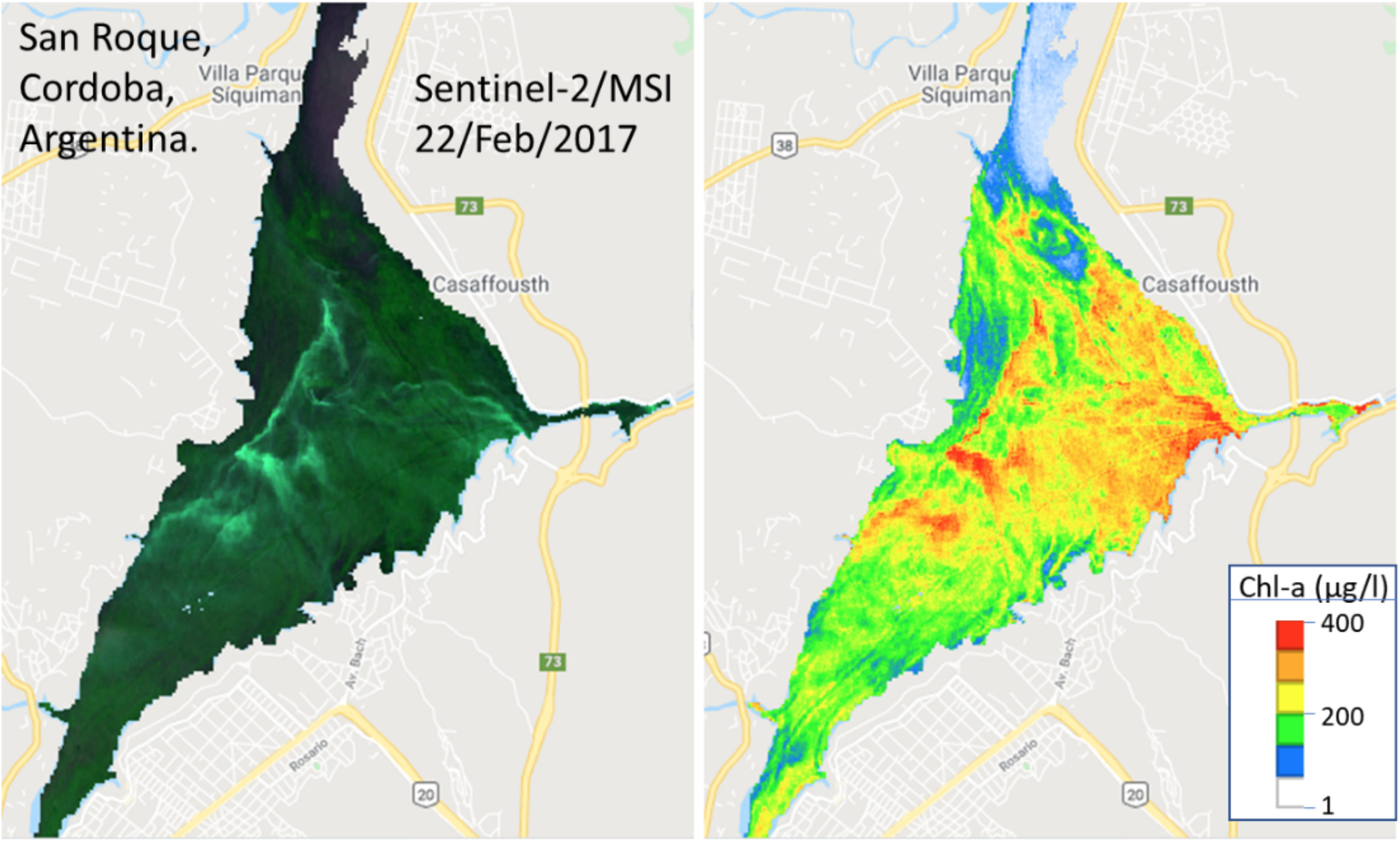
"Human activities have contributed to change the quality of water bodies. Under these circumstances, algae proliferate rapidly and their concentrations are above normal levels. It is urgent that we develop reliable indicators of these overgrowths to support decision makers and society, for the implementation of management actions."
Lilliana María Piedra Castro. Natural Resources and Wildlife Lab, Biological Sciences School, National University, Costa Rica.
“We are very enthusiastic about this project because we will have the means to foster the development of an alert system for algae blooms using satellite imagery on a large scale. This information will be available in a GEE app for general public access and will be shared with local water managers to improve current water resources management in Latin America.”
Felipe de Lucia Lobo (PI). CDTec, Federal University of Pelotas (UFPel), Brazil.
"In Costa Rica, the detection of deforestation, degradation and forest restoration is a complex task because these activities are relatively small and are distributed throughout the territory. With this project we want to achieve the development of more accurate estimates of these dynamics and related carbon emissions, and share this knowledge with other countries that share the same challenges. Additionally, we want to work on building an early warning system that allows generating information in the shortest possible time on illegal activities related to deforestation."
Celeste Lopez, Viceminister of Environmental Management, Ministry of Environment and Energy of Costa Rica.
"We have presented this project as part of the activities that Costa Rica carries out for the construction of the National Land Use, Land Cover and Ecosystems Monitoring System, SIMOCUTE, which is constituted as an integrated monitoring system that allows monitoring to the evolution of natural resources, biodiversity, agricultural activities and urban development in the country. The use of Google Earth Engine can provide access to huge amounts of earth observations databases and allows the processing of this information to carry out different types of analysis. We aim to use this technology to provide more accurate information about the different dynamics. In Costa Rica, there are several public institutions that make use of this tool and we hope that by participating in this Program we can strengthen the technical capacities of our specialists in the use of earth observations."
Rafael Monge, Director of the National Center for Geoenvironmental Information (CENIGA), Ministry of Environment and Energy of Costa Rica.

“Past poverty is predictive of future poverty trends. However, policymakers and researchers lack sufficient data to conduct such predictions. Recently, researchers in the overlap between earth sciences and computer sciences have developed methods that combine machine learning and satellite images to predict poverty. These methods help in filling this data gap, but they require further development. Additionally, these methods are not accessible to policymakers. Our project tackles these challenges. We are therefore excited to be part of the GEO-GEE programme, which will facilitate our research greatly.”
Adel Daoud, Associate Professor in Sociology, Department of Sociology and Work Science University of Gothenburg, & Affiliated Associate Professor in Data Science and Artificial Intelligence, Department of Computer Science, Chalmers University of Technology, Sweden.
"We are very excited and honored our proposal was selected by GEO and GEE. The current pandemic has highlighted the importance of healthy environments to support local and global communities alike, making the proposed work more relevant than ever. Through this project, we will develop a cloud-based platform dedicated to mapping land degradation which identifies potential land restoration opportunities at national to regional scale, allowing communities to prioritize areas to protect, manage, and restore in order to achieve land degradation neutrality. The partnership between Conservation International, NASA, ESA, CSIRO, the UNCCD, and Google Earth Engine will allow us to combine the best of our technical expertise on the usage of Earth Observation data, field experience, and vision to address land degradation and improve human livelihoods."
Mariano Gonzalez-Roglich, PhD, Director, Ecosystem Analysis Moore Center for Science, Conservation International.

“We hope this project will help us to identify areas submitted to natural risks.”
Prof. Solofo RAKOTONDRAOMPIANA, Remote Sensing and Environmental Geophysics Laboratory, Institute & Observatory of Geophysics, Antananarivo (IOGA), University of Antananarivo, Madagascar.

“With the help of Google Earth Engine platform, we would refine the key methodologies for Land Degradation Neutrality monitoring at the global and regional scale, such as improve the accuracy and spatial resolution of land cover and soil carbon, calibrate the climate effects in land productivity change and build the link between field observed degradation and multiple remote sensing indicators, thus to provide dataset, methodology and decision support for United Nations agencies and interested countries, and finally contribute to the realization of Sustainable Development Goals 15.3.1.”
Yuran Cui, Research Assistant and Dr. Xiaosong Li, PH.D, Professor, Aerospace Information Research Institute, Chinese Academy of Sciences.

"EBV-ScaleUp will transform a suite of 'Essential Biodiversity Variables' from proofs-of-concept to application-ready global time-series datasets for land, freshwater and marine realms. These new resources will improve the capacity of subnational, national, and intergovernmental bodies to monitor progress towards biodiversity-related policy targets, especially in the context of the CBD Post-2020 Global Biodiversity Framework and the UN Sustainable Development Goals."
Dr. Carsten Meyer, Head of research group "Macroecology & Society," German Centre for Integrative Biodiversity Research (iDiv) Halle-Jena-Leipzig.

"We are very pleased to have been selected for the GEO-Google Earth Engine program, with which we seek to streamline remote sensing-based processes for coastal zone management and our contribution to solve global problems impacting sustainability of the ocean and coastal zones such as those posed by climate change or disaster risk management. For INVEMAR and the research team, these toolboxes are an opportunity to strengthen our capacities with the latest technology also through leading edge methodologies provide knowledge and services to the scientific community for future research projects oriented to fostering good practices for the conservation of worlds coasts and ocean."
Mr. Julián José Pizarro Pertúz, Systems Engineer, Head of Laboratory of Information Services - LABSIS, Marine and Coastal Research Institute - INVEMAR.
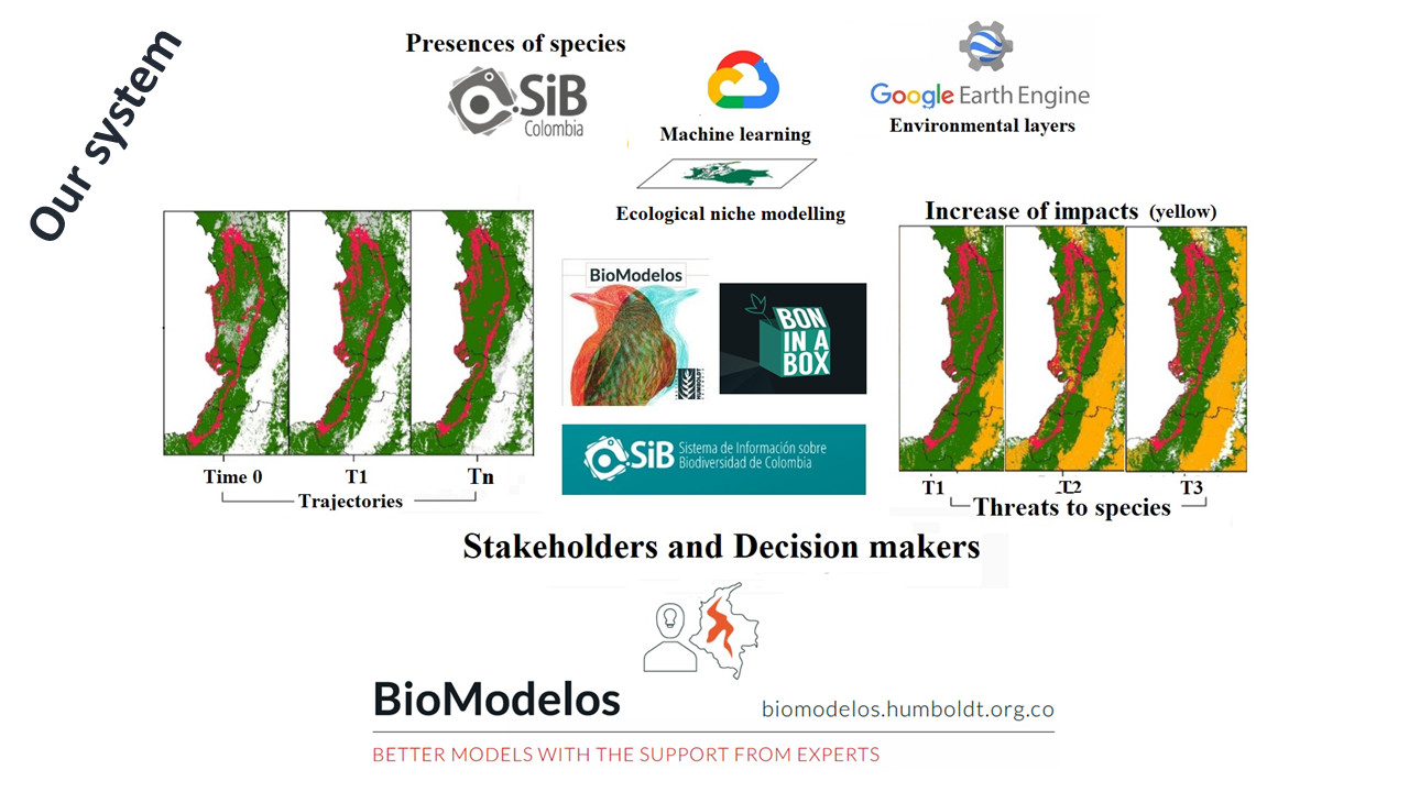
"This project will produce free maps and protocols using GEE data to identify near real-time loss habitat alerts. We will develop tools that allow species monitoring based on the integration of ecological niche modeling techniques (BioModelos system), species records published through SiB Colombia, and data obtained from remote sensing through the Google Earth Engine (GEE). The results of this project could be used to produce national reports for the adequate monitoring and adaptive management and conservation of biodiversity, and improve monitoring indicators."
Elkin Alexi Noguera Urbano, Investigador Adjunto, Evaluación y Monitoreo de la Biodiversidad, Instituto de Investigación de Recursos Biológicos, Alexander von Humboldt.
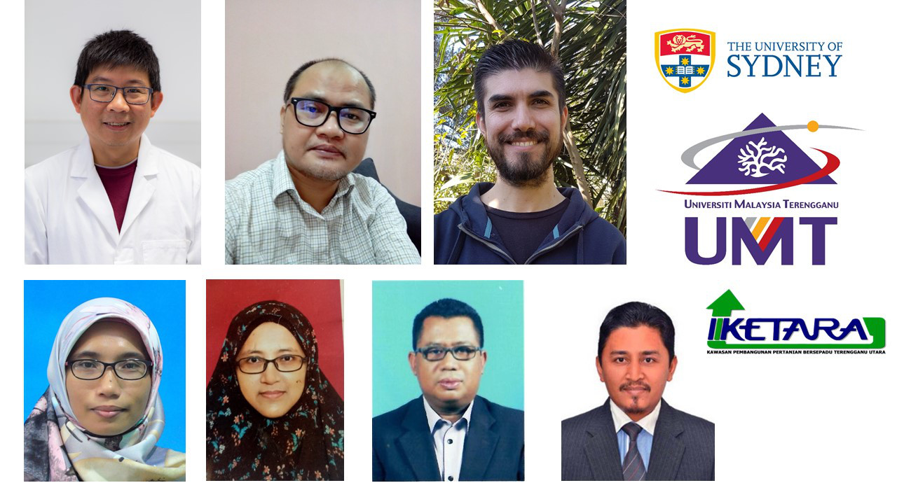
“Accurate and up-to-date information on how much rice has been planted and how much harvest can be achieved is crucial to achieving global food and water security. Working with our partners (Universiti Malaysia Terengganu, IADA Ketara Malaysia, Indonesian Center for Agricultural Land Resources Research and Development, The Institute of Soil Science, Chinese Academy of Sciences, Indian Agricultural Research Institute, and Remote sensing based Information and Insurance for Crops in Emerging Countries Vietnam), we will use the Google Earth Engine to build the first real-time mobile application that will allow farmers, agricultural scientists, non-government organisations and government planners to manage land use to ensure food security in the world’s rice bowls.”
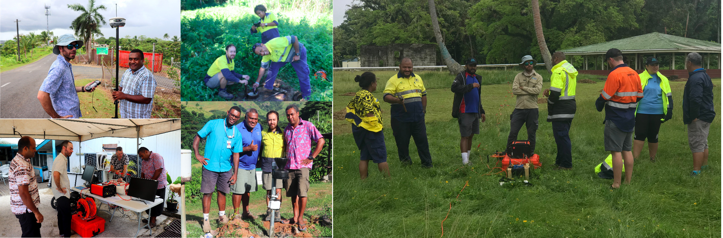
"Here at GEM - SPC, we are excited to be a part of the GEO-GEE programme for the next 2 years. Our Water Resources Team work tirelessly on the ground with local partner organisations for water security and WASH outcomes for communities across the Pacific region. The programme would allow us to not only create useable water security-related datasets but also to build knowledge and capacity in the utilisation of Geospatial data and tool, including GEE, to better compliment the work we do on the ground."
Nicholas Metherall (GIS and RS Data and Monitor Advisor, Global Evergreen Alliance) and Carrol Chan (GIS/RS Project Assistant, SPC)

"We appreciate the GEO-GEE project financial support. The fusion of computing power of the Google Earth Engine cloud platform and our deep learning methods for land cover and land use classification based on satellite data that have been previously developed and validated within the World Bank program will allow us to develop the sustainable (operational) technology for crop area estimation and real land use monitoring, land cover change monitoring, double crops detection and monitoring, detection and monitoring of crop rotation violations, drought detection and monitoring and calculating SDGs indicators 15.3.1 and 2.4.1 on global scale and consequently for governmental use and decision making."
Yuliia Bilokonska on behalf of the Deep Learning Methods for Land Cover and Land Use Classification team.

"The goal of OSS’s “Sustainable water management for agriculture” project is to setup an operational system for monitoring agriculture irrigation and water uptakes through the exploitation of earth observation data and technologies. On the basis of regular new satellite imagery acquisitions (instead of relying on static inventories with reduced quality), the project will provide an accurate updated information on agricultural campaign as well as water abstraction in irrigated areas, ensuring compliance with the food security issues and seasonal water allocation restrictions management."
MIMOUNI Mustapha, Expert en Télédétection, Observatoire du Sahara et du Sahel (OSS).

"The mitigation of problems, such as global warming, sustainability, pandemics, should begin by recognizing that they affect the most vulnerable first. However, traditional survey-based methods are slow and costly, and, for highly dynamic areas, the data are mostly outdated when they are finally published. Additionally, data often gets aggregated at geographically arbitrary units, which averages and hides poor areas. Remote sensing, machine learning, and cloud computing, together with statistical information, can provide complete and timely data analysis. This analysis will improve quantitative models to estimate sociodemographic variables relevant for decision making and for truly leaving no one nowhere behind."
Elio Atenogenes Villaseñor Garcia, Director of Data Science Lab, INEGI
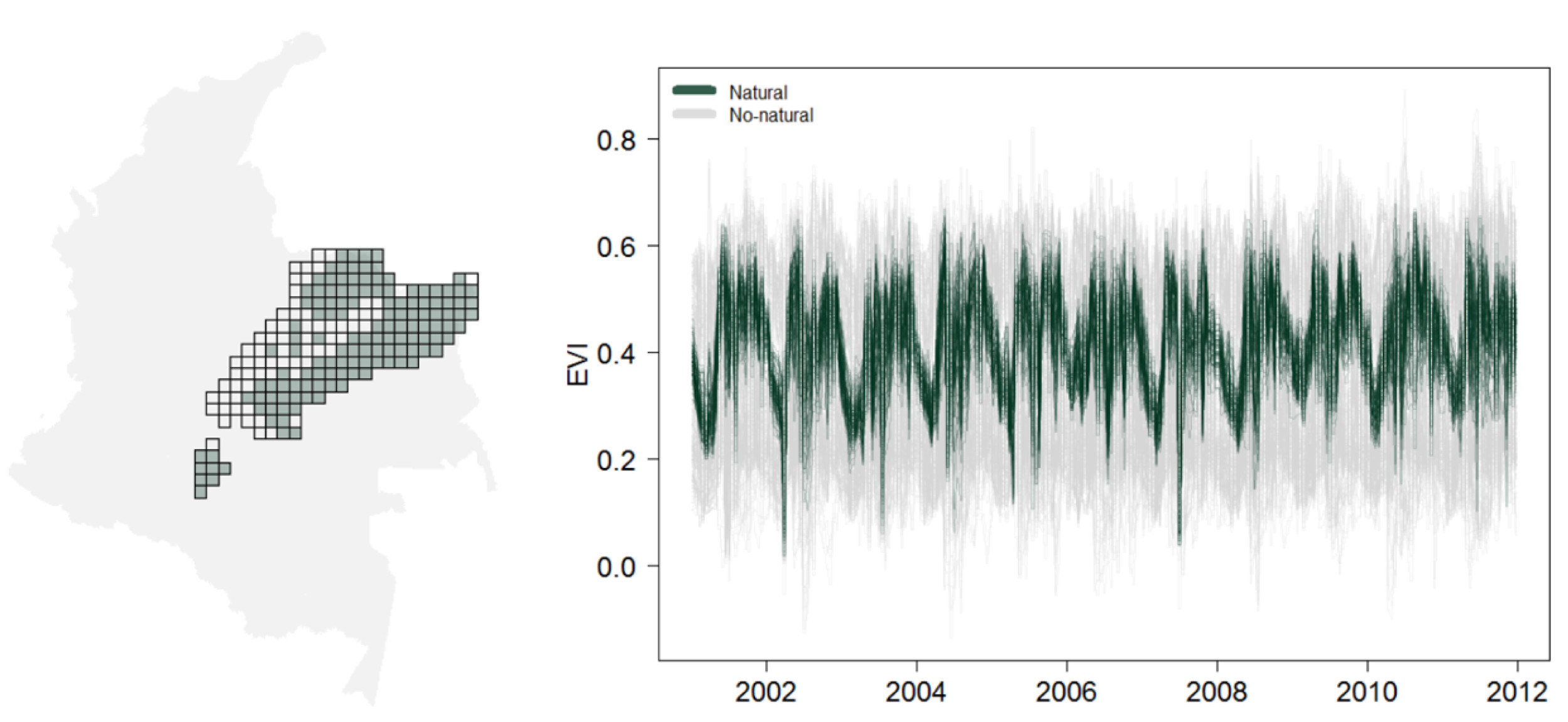
"The Ecological Integrity Index (EII) aims to use Earth observations to describe temporal and spatial dynamics in each ecosystem, identifying natural trends and likely perturbations. “This opportunity will allow us to test the index and cooperate with the Humboldt Institute, National Parks office, Conservation International, and The Nature Conservancy in Colombia which are seeking solutions to environmental challenges related to sustainable land and water use in a changing climate."
"We are thrilled to be among the selected projects and to be able to develop our idea with the support of the GEO-Google Earth Engine Programme"
Ivan Gonzalez, GEODE lab Ph.D. student
The project team consists of Ivan Gonzalez (NAU-SICCS), Scott Goetz (NAU-SICCS), and Patrick Jantz (NAU-SICCS) with collaborators Andrew Hansen (Montana State University), María Cecilia Londoño Murcia (Instituto Alexander von Humboldt), Natalia Acero (Conservation International), Juan Carlos Clavijo Flórez (National Natural Parks), and Jorge Velásquez-Tibatá (The Nature Conservancy).
Follow us on:


