


Open call to the GEO community: Contribute to the World Environment Situation Room by sharing your in situ data
News / 1 October 2020

The World Environment Situation Room (WESR) is the future United Nations Environment Programme (UNEP) online data and knowledge platform. It will enable users to visualize, interrogate, access, link and download data, information and knowledge products regarding the world environment situation in near real-time. This platform will be a primary tool for UNEP’s data-driven assessments, foresights, monitoring, communications, and support to UN country teams and related Common Country Analysis (CCA). It will also help visualize progress made regarding the environment-related Sustainable Development Goals (SDGs) and Multilateral Environmental Agreements (MEAs). The WESR will be customized to fulfil UNEP’s mandates and fill both an important and unique niche in the emerging digital infrastructure for the planet.
The WESR is being built by UNEP, a GEO Participating Organization,along with a network of partners including GRID centres, World Conservation Monitoring Centre (WCMC), World Resources Institute (WRI), the Joint Research Centre (JRC) of the European Commission, IBM, Descartes, Esri, Google, UNEP DHI, the European Space Agency (ESA), NASAand the GEO community.
When fully functional, this online platform will provide reliable, authoritative information to user son the matic areas, such as air quality, biodiversity, pollution and water quality. The WESR will comprise features and functions for transforming data to positive actions, including searches powered by machine learning, third party data streaming, geospatial layers and custom maps, statistical data for the SDGs and MEAs, data visualization tools and integrated dashboards for all types of statistics and indicators, country profiles, and an online library to access publications and scientific reports.
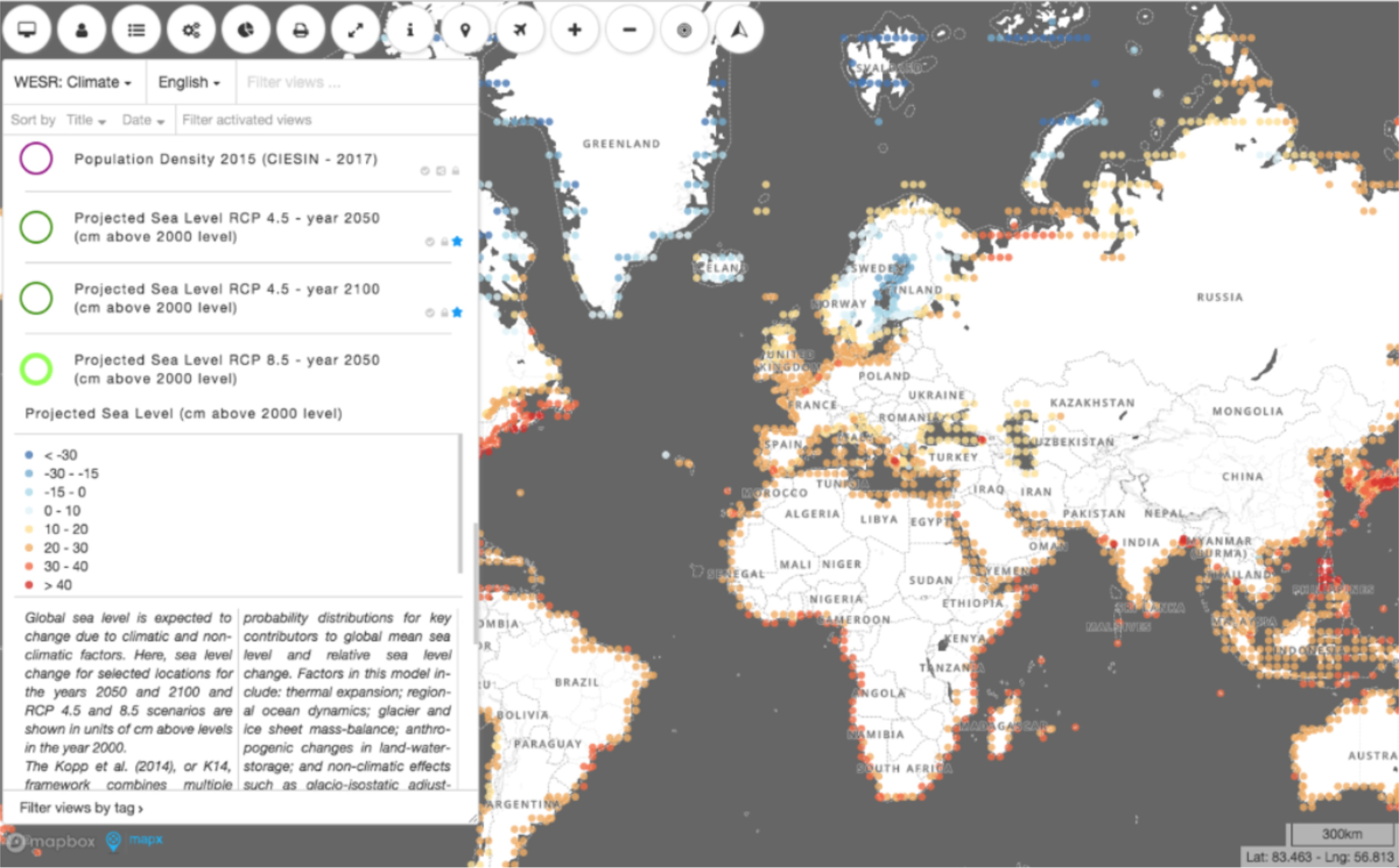
In terms of visualization functionalities, the WESR includes MapX, an online, open source geospatial data platform. MapX brings a high level of interactivity to data through dashboards and various tools for data querying. For example, real-time, in situ measurements of air quality in Addis Ababa, Ethiopia are openly available in a simple format. A demonstration of the interface can be found here.
Efforts towards the creation of such a platform is based on the United Nations Environment Assembly (UNEA) 4th Summit, Resolution 23, item 5b which supports:“The improvement of platforms that provide a repository function, to allow open access to up-to-date, quality-assured, credible and relevant data, including geospatial data, statistics, indicators and data analysis on the environment, including the work of the Global Resource Information Database (GRID) centres.”
With the objective of strengthening this platform and harnessing the expertise of the GEO community, data providers and GEO Work Programme activities are invited to participate in the WESR project by making accessible relevant, near-real time in situ data available in the following domains:
Through this collaboration, UNEP and GEO aim to bring significant value to geospatial information, showcase benefits of open data sharing and bring insights to decision makers, as well as any citizen willing to learn about how the environment is evolving.
This is an open call to the GEO community to get involved. If you are interested in contributing to this project or have any questions, please contact Florian Franziskakis from the GEO Secretariat (ffranziskakis@geosec.org) by the 30th of November 2020, please copy secretariat@geosec.org.
Follow us on:


