


Blog / Virginia Gorsevski / May 15, 2020
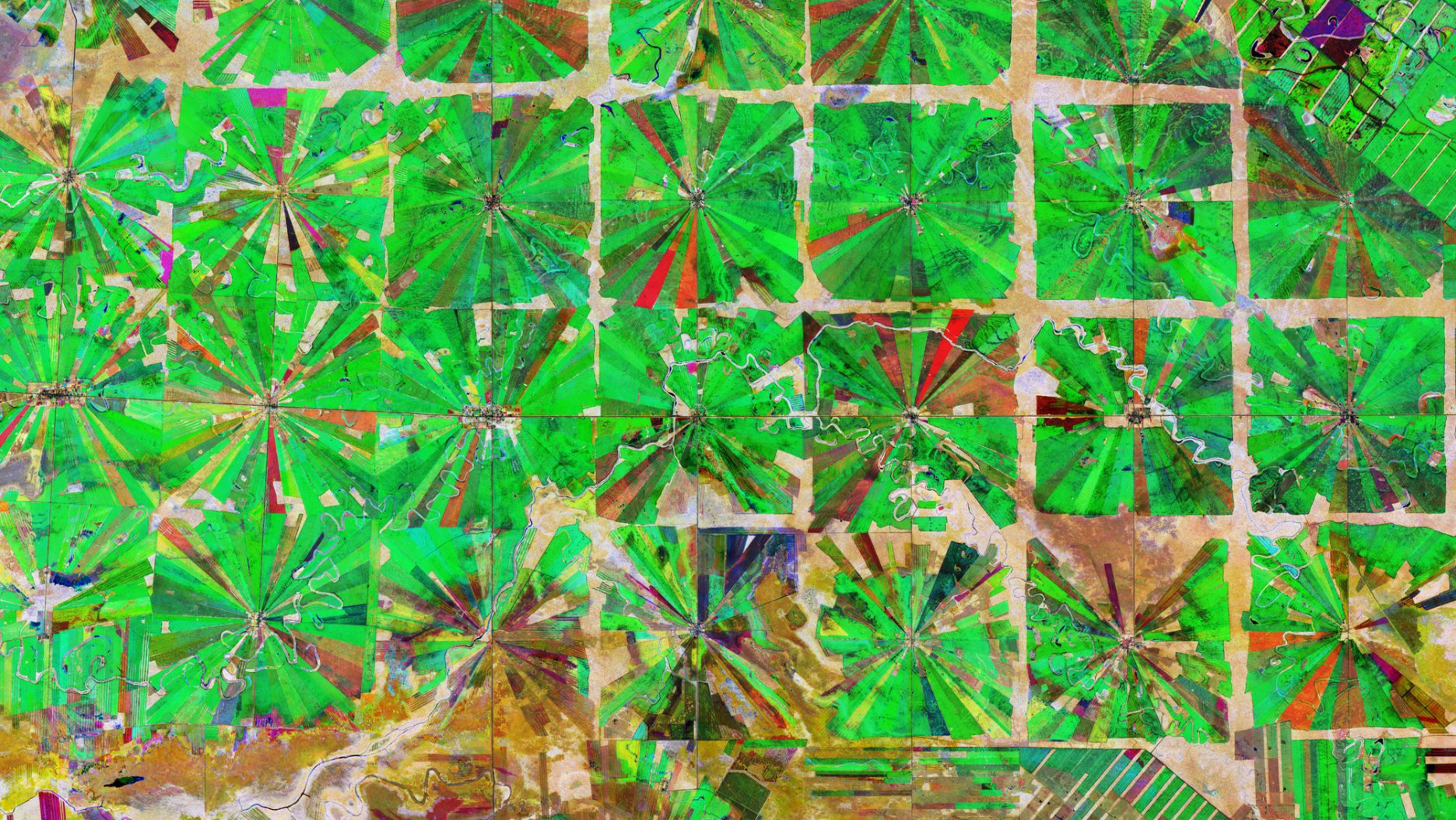
Since the Global Environment Facility (GEF) was created 28 years ago, a digital revolution has taken place. Data from satellite remote sensing and other Earth observations (EO) technologies have become much more regular, widespread, less costly and more widely accessible. Together with scientific and technological advances such as cloud computing, machine learning, and data sharing, EO data offers researchers the opportunity to observe, monitor, and predict environmental and social phenomena with greater efficiency and precision.
Many GEF projects and programs are already using EO data to design, implement, monitor, and evaluate interventions. However, the uptake and use of Earth observation technology by GEF agencies is uneven. Since 2017, the Project Information Form (PIF) requires project proponents to provide a map and geo-coordinates of the project’s location. A PIF map could benefit from being integrated with information derived from EO, but there remains limited guidance on how this information should be provided.
The Scientific and Technical Advisory Panel (STAP) at GEF is responsible for connecting the GEF to the most up-to-date, authoritative, and globally representative science and for making recommendations on GEF policies, programs and projects. Working with STAP, the Group on Earth Observations (GEO) has provided inputs into a new report to help address gaps and offer recommendations to advance Earth observation use within GEF programming.

The Technical Guide and accompanying Primer, led by Andy Dean of Hatfield Consulting with inputs from across GEF, provides a detailed explanation of Earth observation principles, data sources and platforms. The Earth Observation and the Global Environment Facility Technical Guide provides GEF and non-GEF case studies to illustrate how these data and tools can be used, and guidance on how to meet the PIF requirements.
This information is useful for programme managers to understand the key benefits of Earth observation technology and data, and to better integrate EO data into cross-cutting and high impact environmental or conservation projects.
To advance Earth observation use within GEF programming STAP recommends that:
For more information, download the two new publications here:
Earth Observation and the GEF primer.pdf
Earth Observation and the Global Environment Facility Technical Guide
Full citation:
Dean, A.M.. 2020. Earth Observation and the Global Environment Facility. Technical Guide. Prepared for the Scientific and Technical Advisory Panel to the Global Environment Facility. Washington, DC.
Virginia Gorsevski comes to the STAP Secretariat with nearly two decades of experience working in the field of conservation and climate change in the United States and in developing countries. As a Programme Officer in the STAP Secretariat, Virginia is responsible for managing the biodiversity portfolio which includes developing practical guidance on issues related to protected area management and the illegal trade in wildlife. Prior to joining STAP, Virginia worked as a Program Manager at the United States Environmental Protection Agency (USEPA) and the United States Agency for International Development (USAID) to develop projects and programs aimed at mitigating climate change through energy efficiency and renewable energy.
More recently she turned her focus toward monitoring land cover and land use change using satellite remote sensing as a researcher at the University of Maryland, where she received her Ph.D in Geographical Sciences. Her research focused on the impact of conflict on forest cover in South Sudan. Virginia also holds a Master’s Degree in International Relations from the Johns Hopkins University School of Advanced International Studies (SAIS) and a Bachelor’s Degree in International Affairs from the University of Colorado, Boulder.
Follow us on:


