
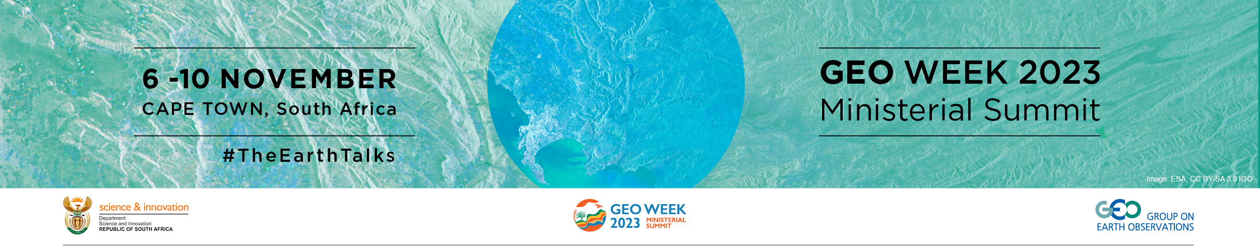
GEO Week
and Inclusion
The Earth is talking and it's time to listen.
Climate. Biodiversity. Air quality. The planet has a lot to say about the things that each and every one of us depend on.
But can you hear what it’s saying?
There is more data than ever before on our changing Earth. The problem is that many people can’t get hold of it, and when they can, it’s in a language they don’t understand.
If we’re going to act on what the planet is saying, we need an organization that can bring together the best Earth observation data, technology and science and translate it into free, trusted information that makes sense to everyone.
That organization is GEO. We are coming together at the Cape Town Ministerial Summit to shape our future and respond to the Earth’s calls for action.
Join us for a conversation like no other.
WHY ATTEND?
Showcase and discover solutions
In the past four years, GEO has advanced the sharing of open knowledge, enhanced coordination, and developed tools and services that respond to specific global policy challenges. Find out more and showcase your own solutions at GEO Week 2023
Unlock action
Earth observations can provide the information needed to unlock action on the triple planetary crisis of climate change, biodiversity loss and pollution, and drive sustainable development. It’s time to renew our commitment to GEO and forge new partnerships.
Demonstrate leadership
GEO Week and the Ministerial Summit will provide an opportunity to highlight contributions, commitments and Earth observation solutions on a global stage.
Network
The gathering of Ministers, as well as representatives from private sector, civil society and international organizations, represents a unique opportunity for high level networking and discussion.
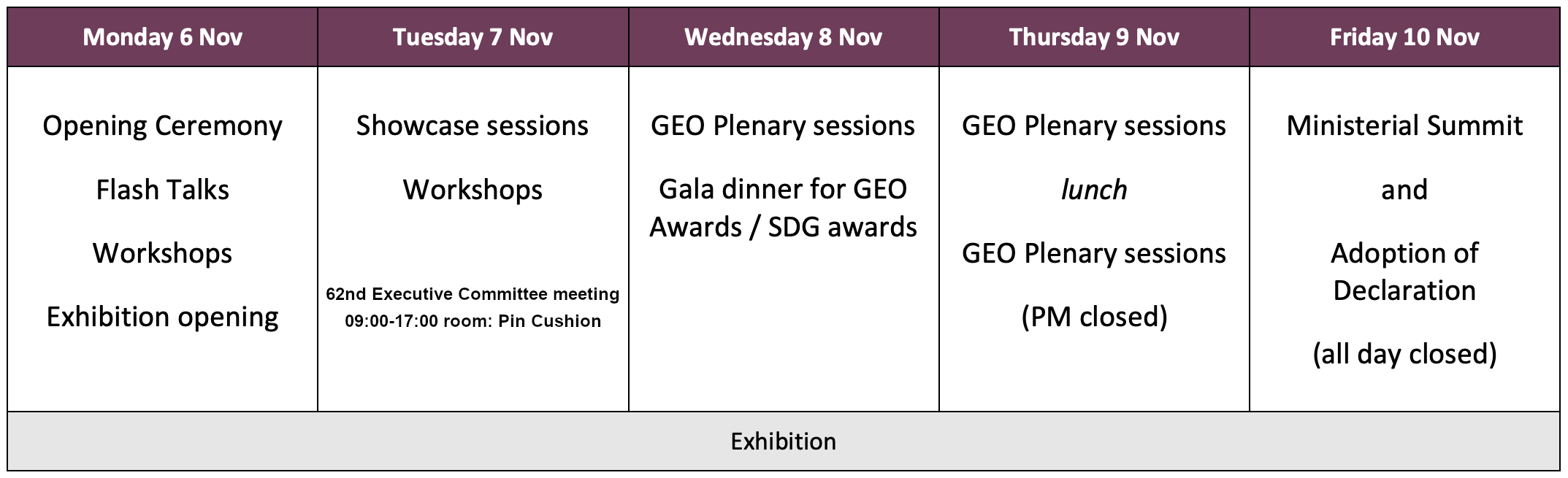
WEEK AT A GLANCE
Remarks
- Exhibition runs all week
- Days 1, 2 and 3, as well as the morning of Day 4 are open to all registered attendees. The afternoon of Day 4 and the Ministerial Summit are only open to GEO Delegates and Ministers. Please note that while thematic sessions during the plenary are open to non delegates, any decisions will be made by GEO Members present.
- GEO Week and the Ministerial Summit will be in-person events with some sessions broadcast through a livestream.
Please send any questions on GEO Week and the Ministerial Summit to geoweek@geosec.org
LIVESTREAM
EQUALITY, DIVERSITY and INCLUSION
The Equality, Diversity and Inclusion (EDI) Subgroup of the GEO Programme Board supports the strategic aim of developing GEO as an institution that provides a fair, supportive and encouraging networking environment that insures that equality, diversity, and inclusivity are fully considered, addressed, and embedded within GEO activities and decisions.
To that end, the EDI subgroup and GEO Secretariat encourage diversity and inclusion in GEO Week plenary sessions and side events.
Meet, greet, and discuss
The Equality, Diversity and Inclusion Subgroup of the GEO Programme Board invites you to an informal “meet, greet, and discuss” diversity dialogue on Tuesday, November 7, at 10:00 AM, in the Bluebell room at the Cape Town International Conference Centre 2. We welcome all who are interested in advancing GEO’s goals for equity, diversity and inclusion. Topics include Indigenous engagement, gender gaps, and youth engagement. Room to be announced. Bring your own coffee; breakfast snacks will be provided.
We recommend that session organizers:
- Include conveners and speakers from multiple countries and institutes, preferably with a diverse representation of GEO-member countries;
- Have conveners and speakers from different career stages, including at least one early career speaker (but not only early career); and
- Include conveners and speakers that represent more than one form of gender identity.
PROGRAMME DETAILS
Mon 6 Nov
Tue 7 Nov
Wed 8 Nov
Thu 9 Nov
Fri 10 Nov
6 Nov
7 Nov
8 Nov
9 Nov
10 Nov
6 NOVEMBER
09:30
Official Opening Ceremony
- Performance by South Africa Youth Choir
- Opening by Master of Ceremonies, Veli Mbele, Deputy Director, DSI
- Welcome from the Deputy Major of Cape Town, Edwin Peter Andrews
- Remarks from Phil Mjwara, Director General, Department of Science and Innovation, South Africa
- Video address from Amina Mohammed, United Nations Deputy Secretary-General
- Remarks from Rainer von Brandis, Research Director, National Geographic Okavango Wilderness Project
- Remarks from youth representative Thobeka Zondi
- Closing remarks from GEO Secretariat Director Yana Gevorgyan
10:30
Coffee Break
11:00
Flash Talks
room: Daisy
room: Freesia
room: Orchid
12:00
Open space flash talk follow ups and networking
12:30
Lunch
14:00
Flash Talks continued
room: Daisy
Using Time Series Analysis of Surface Deformation Using Sentinel 1 SAR Along Planned Railway Infrastructure Extension
Ndilisa Didiza (Kgothatso Innovations)
The geospatial applications of Web GIS platform (PolarGo.cn) on Antarctica
Ai Songtao (Wuhan University)
GEOGLAM, more than a decade of earth observation in support of food security
Sven Gilliams (GEOGLAM)
room: Freesia
room: Orchid
Guaranteeing continuity of Earth observation global default datasets for monitoring SDG 15.3.1 Indicator
Gabriel Daldegan (Conservation International), Bernd Eversmann (German Agency for International Cooperation - GIZ)
15:30
Coffee Break
16:00
Workshops and Technical Meetings (self-organized)
room: Bluebell
In situ data in GEO: challenges and opportunities. Sharing experiences between Regional GEOs.
José Rubio (European Environment Agency - EEA), Angelica Gutierrez (NOAA), GU Xingfa (IRSA, Chinese Academy of Science), Michael Otieno (Humanitarian OpenStreetMap Team (HOT), Jean Dusart (European Commission), Josh Delmonico (USGS FGDC), Rich Frazier (FGDC), Brian Goldin (USGeo/amerigeo/Voyager Search), Kofi Asare (Ghana Space Agency), LIU Chuang (Institute of Geographic Sciences and Natural Resources Research, Chinese Academy of Sciences), Hiroyuki Muraoka (Gifu University, Japan GEO), Antje Hecheltjen (GEO-LDN), Lionel Menard (MINES Paris PSL)
room: Daisy
room: Freesia
The City Talks – HARMONIA solutions & potential synergies in urban domain among GEO Community
Julia Nerantzia Tzortzi (HARMONIA), Mikko Strahlendorff (Finnish Meteorological Institute - FMI), Yifang Ban (KTH Royal Institute of Technology), Betty Charalampopoulou (Geosystems Hellas SA), Nektarios Chrysoulakis (Foundation for Research and Technology Hellas - FORTH), Ioannis Kavouras (ICCS, HARMONIA IRAP)
room: Orchid
Joint GEO Working Groups Workshop
Sara Venturini (GEO Secretariat), Mark Dowell (GEO Climate Change-WG co-chair), Juli Trtanj (NOAA), Evangelos Gerasopoulos (RCHS-WG), Sousan Torabiparizi (UNFCCC Secretariat), Nancy Searby (GEO DRR-WG co-chair), Nathaniel Newlands (GEO DRR-WG co-chair), Virginia Burkett (GEO Climate Change-WG co-chair), Kene Onukwube (GEO DRR-WG co-chair), Charles Balagizi (Goma Volcano Observatory), David Borges (GEO DRR-WG co-chair), Allison Craddock (GEO Capacity Building WG co-chair), Angel Valdiviezo (GEO Climate Change WG co-chair)
room: Protea
room: Watsonia
EO data-driven agricultural and water use monitoring, prediction, and smart decision making
Liping Di (George Mason University), Jiali Shang (Agricultural and Agri-Food Canada), Liying Guo (George Mason University), Faisal Mueen Qamer (International Center for Integrated Mountain Development), Feng Gao (USDA Agricultural Research Service), Mark Noort (HCP International)
18:15
Networking Social * Official Exhibition Opening *
19:15
Adjourn
Open to all registered attendees
7 NOVEMBER
09:30
Showcase Events
room: Daisy
room: Freesia
Call to Action: Sustainability on Earth Depends on Sustainability in Space
Krystal Azelton (Secure World Foundation - SWF), Pontsho Maruping (South African Radio Astronomy Observatory - SARAO), Danielle Wood (Media Lab Space Enabled Research)
room: Orchid
National and EU initiatives’ contribution for addressing human and environmental Health and Disaster Crisis
Giovanni Rum (Italian Space Agency - ASI), Evangelos Gerasopoulos (National Observatory of Athens - NOA), Eleni Athanasopoulou (National Observatory of Athens - NOA), Nicola Pirrone (National Research Council of Italy - CNR), Sergio Cinnirella (National Research Council of Italy - CNR), Haris Kontoes (National Observatory of Athens - NOA/BEYOND ), Alexia Tsouni (National Observatory of Athens - NOA/BEYOND )
10:30
Coffee Break
11:00
Showcase Events continued
room: Daisy
Fire and Ice: Space for Climate Action – High Level Summary of the IAF Global Space Conference on Climate Change (GLOC 2023) Findings and Recommendations
Barbara Ryan (World Geospatial Industry Council - WGIC), Christian Feichtinger (International Astronautical Federation - IAF), Myriam Morabet (International Astronautical Federation - IAF), Richard Spinrad (National Oceanic and Atmospheric Administration - NOAA)
Empowering Climate Action: Impact Stories from the Space for Climate Observatory
Frédéric Bretar (National Centre for Space Studies - CNES), Emmanuel Brempong (Institut de Recherche pour le Développement – project WACA-VAR), Elodie Blanchard (Institut de Recherche pour le Développement – project MANGROVES), Florent Veillon (Institut de Recherche pour le Développement – project Cimopolée)
room: Freesia
From Big Data to Better Decisions: Disaster Risk Reduction (DRR) and Climate Resilience for Small Island Developing States (SIDS)
Nathaniel Newlands (Agriculture and Agri-Food Canada and Statistics Canada), Angelica Gutierrez (National Oceanic and Atmospheric Administration - NOAA), Nancy Searby (USGEO/NASA), Virginia Burkett (United States Geological Survey - USGS), Lennox Gladden (National Climate Change Office of Belize)
What does the Earth tell us in terms of hazards and vulnerabilities?
Miguel Angel Exposito Verdejo (European Commission), Fabio Venuti (European Centre for Medium-Range Weather Forecasts - ECMWF), Vincent Gabaglio (European Organisation for the Exploitation of Meteorological Satellites - EUMETSAT), Muliro Mashauri (United Nations Office for Disaster Risk Reduction - UNDRR)
Over a decade of collaboration and cross-benefits - NASA’s Contributions to GEO
Meghavi Prashnani (NASA Harvest UMD), Ashutosh Limaye (NASA)
room: Orchid
Digital Earth Pacific – a public digital infrastructure serving operational earth observation products and services
Andiswa Mlisa (Pacific Community - SPC), Sachindra Singh (Pacific Community - SPC), Aditya Agrawal (D4DInsights)
Melding AquaWatch & Global Indigenous Knowledge (MAGIK)
Neil Sims (Commonwealth Scientific and Industrial Research Organisation - CSIRO), Diana Mastracci (Indigenous Alliance), Janet Anstee (Commonwealth Scientific and Industrial Research Organisation - CSIRO), Marie Smith (GEO AquaWatch)
12:30
Lunch
14:00
Showcase Events continued
room: Daisy
Leveraging Earth Observation data to monitor and evaluate WFP’s resilience projects from space
Paola Di Francesco (UN World Food Programme - WFP )
room: Freesia
Unlocking Africa’s Geospatial Potential: Insights on Water Management, Cross-Continental Partnerships and Supporting SMMEs
Imraan Saloojee (Research Institute for Innovation and Sustainability - RIIS), Zviko Mudimu (DE-Africa), Mansoor Leh (International Water Management Institute - IWMI)
Measuring Essential Variables with high-level satellite products, in-situ sensors and API standards
Joan Maso (University of Barcelona), Alba Brobia, Ivette Serral, Andreas Matheus
room: Orchid
EO data and technologies support sustainable practices and mining policies
Gerardo Herrera (European Commission DG Grow), Veronika Kopačková-Strnadová (Senior scientist at CGS and Copernicus programme consultant EUSPA), Abdul Wadood Moomen (University of Energy and Natural Resources), Irene Benito (Planet.)
Global Ecological Environment Monitoring, mapping and evaluation
Mpho Sadiki (DE-Africa), Jiang Ming (Northeast Institute of Geography and Agroecology, Chinese Academy of Sciences), Qinhuo Liu (Aerospace Information Research Institute, Chinese Academy of Sciences), Amadou Sall (Centre de Suivi Ecologique - CSE)
15:00
Coffee Break
15:30
Open space for Showcase follow ups and networking
16:00
Workshops and Technical Meetings (self-organized)
room: Bluebell
Earth Observations in Support of the Sustainable Development Goals: Opportunities and Challenges
Osamu Ochiai (Japan Aerospace Exploration Agency - JAXA), Miguel Angel Exposito Verdejo (European Commission), Steve Kopp (Esri), Monica Miguel-Lago (European Association of Remote Sensing Companies - EARSC), Yuzhou Liu (Shenzhen Technology Institute of Urban Public Safety), Michele Melchiorri (EC Joint Research Center - JRC)
room: Daisy
From Data to Open Knowledge implementation: efforts to grow the value chain
Paola De Salvo (GEO Secretariat), Lionel Menard (Mines Paristech), Bente Lilja Bye (BLB), Lea Shanley (Berkley University), Juliet Hermes (SAEON), Tammy Morris (SAEON), Jose Miguel Rubio Iglesias (European Environment Agency - EEA), Joan Masó (University of Barcelona), Paolo Mazzetti (National Research Council of Italy - CNR), Albana Kona (European Commission), Mattia Santoro (National Research Council of Italy - CNR), Gregory Giuliani (University of Geneva), Joost van Bemmelen (European Space Agency - ESA), Felipe Carlos (GEO Secretariat), Dominique Conard - Tilmans (EURISY)
room: Freesia
From raw data to Earth Intelligence for land degradation neutrality
Nils Hempelmann (Open Geospatial Consortium - OGC), Alex Zvoleff (Conservation International), Gabriel Daldegan (Conservation International), David Borges (CEOS/NASA), Gregory Giuliani (University of Geneva), Barron Joseph Orr (United Nations Convention to Combat Desertification - UNCCD), Sara Minelli (United Nations Convention to Combat Desertification - UNCCD), Brian O’Connor (United Nations Convention to Combat Desertification - UNCCD), Neil Sims (Commonwealth Scientific and Industrial Research Organisation - CSIRO), Ingrid Teich (Uni Bern, CDE, WOCAT), Ingo Simonis (Open Geospatial Consortium - OGC), Amos Kabo-Bah (University of Energy and Natural Resources/International Research Center of Big Data for Sustainable Development Goals - CBAS), Phoebe Oduor (Regional Centre For Mapping Of Resources For Development - RCMRD), Mark Grasy (German Agency for International Cooperation - GIZ), Joost Teuben (University of Twente)
room: Orchid
Capacity co-development opportunities for impactful Agriculture and Food Security interventions
Andy Nelson (University of Twente), Esther Makabe (GEOGLAM), Joost Teuben (University of Twente), Vivianne Meta (LocateIT Limited), Jane Kioko
room: Protea
Training Workshop of Earth Observations (EO) Solutions for the Early Warnings for All (EW4All) Initiative
Jens Danzeglocke (German Aerospace Center - DLR), Giriraj Amaarnath (International Water Management Institute - IWMI), Masaki Yasukawa (University of Tokyo / MEXT, Japan), Katsunori Tamakawa (International Centre for Water Hazard and Risk Management - ICHARM), Adrian Strauch (University of Bonn), Sousan Torabiparizi (UNFCCC Secretariat), Shanna Mcclain (NASA), Ernest Acheampong (GEO Secretariat), Ariesta Ningrum (UNFCCC Secretariat), Rui Kotani (GEO Secretariat)
room: Watsonia
18:15
Social event
Exhibition Area
Reception at EuroGEO and GEO booth
Open to all registered attendees
8 NOVEMBER
GEO-19 PLENARY - draft agenda
09:00
Session 1: Opening Session
Moderator: Ayanda Allie
Welcome from the Lead GEO Co-Chair:
- Mmboneni Muofhe, Deputy Director General, Department of Science and Innovation, South Africa
Welcome from South Africa:
- Buti Manamela, Deputy Minister of Science and Innovation, South Africa
GEO Co-Chairs:
- Jing Zhao, Director General, National Remote Sensing Center, China
- Joanna Drake, Deputy Director-General, DG Research and Innovation, European Commission
- Richard Spinrad, Undersecretary of Commerce for Oceans and Atmosphere, National Oceanic and Atmospheric Administration (NOAA) Administrator, United States
GEO Secretariat:
- Yana Gevorgyan, Director, GEO Secretariat
Approval of Agenda
Approval of Draft Report of GEO-18
Welcoming new GEO Members and Participating Organisations
10:10
Coffee Break and Group Photo
10:45
Session 2: Post-2025 Strategy
Session Objectives: The primary objective is to present the GEO Post-2025 Strategy for formal adoption by the GEO Plenary. The Plenary will be invited to show their commitment and support to the Strategy.
Moderator: Ayanda Allie
Presentation of the GEO Post-2025 Strategy by the Co-Chairs of the Post-2025 Working Group:
- Alejandro Román, General Director of Aerospace Development, Paraguay Space Agency, Paraguay
- Samantha Burgess, Deputy Director Copernicus Climate Change Service, European Centre for Medium-range Weather Forecasts (ECMWF)
Speaker statements:
- Sofiia Drozd, Igor Sikorsky Kyiv Polytechnic Institute, National Technical University, Ukraine
- Maree Wilson, Branch Head Digital Earth Branch, Space Division, Geoscience Australia (GA), Australia
- Titus Letaapo, Co-founder of the GEO Indigenous Alliance and Director of community and programs, Sarara Foundation (TSF), Kenya
- Emmanuel Pajot, Secretary-General, European Association of Remote Sensing Companies (EARSC)
- Andiswa Mlisa, Principal Advisor Business Development, Pacific Community (SPC)
Interventions by Plenary
Session outcomes and recommendations
12:00
Lunch
14:00
Session 3: Ministerial Declaration
Session Objectives: The main objective of this session is to introduce the draft Ministerial Declaration to the GEO Plenary before it is shared with ministers for adoption and present the Ministerial Summit Agenda.
Moderator: Ayanda Allie
Presentation of the Ministerial Declaration and Ministerial Summit Agenda by the Co-Chair(s) of the Ministerial Working Group:
- Humbulani Mudau, CEO, South African National Space Agency (SANSA), South Africa
- Lawrence Friedl, Director Applied Sciences Program, National Aeronautics and Space Administration (NASA), United States
- Yasuko Kasai, Committee on Space Research (COSPAR)
14:20
Session 4: Igniting Action - the GEO Global Ecosystems Atlas
Session Objectives: Session 4 will introduce the first of the two major programmatic efforts that GEO has been leading since GEO-18 that present proof of concept for the Post-2025 Strategy. The session will present the Global Ecosystems Atlas, providing an overview of its purpose, real-world applications and user perspectives, illustrating its continuous value within the post-2025 GEO framework.
Moderator: Marco Lambertini, Special Envoy, World Wide Fund for Nature (WWF) International / Convener of the Nature Positive Initiative
Atlas Video
Panel discussion:
- Joanna Drake, Deputy Director-General, DG Research and Innovation, European Commission
- Jixi Gao, Director, Satellite Application Center for Ecology and Environment (SACEE), Ministry of Ecology and Environment, China
- Miriam Grigg, Deputy Director for International, Sustainability, Regulation and Earth Observation Strategy, Space Directorate, UK Department for Science, Innovation and Technology (DSIT), United Kingdom
- Andrew Skowno, Lead, National Biodiversity Assessment Unit, South African National Biodiversity Institute (SANBI), South Africa
- Ahmed Raidh, Senior Coastal Analyst, Environment Management and Conservation Department, Ministry of Environment, Climate Change and Technology, Maldives
Interventions by Plenary
Session outcomes and recommendations
15:30
Coffee Break
16:00
Session 5: Driving Collaboration for Early Warnings for All: the GEO Global Heat Resilience Service
Session Objectives: GEO is an implementing partner of the Early Warnings for All (EW4All) Initiative. Session 5 will introduce the second proof of concept for the Post-2025 Strategy: GEO’s Global Heat Resilience Service, which is GEO’s contribution towards advancing EW4All. The Service provides every urban area in the world with intelligence on the health risks from exposure to extreme heat. These insights will help cities develop plans to adapt to heat and reduce the impact on citizens’ health and local economies.
Moderator: Ayanda Allie
Introduction to EW4All and the Global Heat Resilience Service:
- Johan Stander, Director, Services Department, World Meteorological Organization (WMO)
- Juli Trtanj, Co-Chair, Global Heat Health Information Network (GHHIN) Management Committee
Panel discussion on the Global Heat Resilience Service:
- Geordin Hill-Lewis, Executive Mayor of Cape Town
- Lennox Gladden, Activity Lead, Technology Executive Committee (TEC), the United Nations Framework Convention of Climate Change (UNFCCC) / Chief Climate Change Officer, Ministry of Sustainable Development, Climate Change and Disaster Risk Management, Belize
- Jessica Kavonic, Head of Implementation, Africa, C40 Cities
Interventions by Plenary
Session outcomes and recommendations
17:00
Adjourn
18:00
Gala dinner with awards ceremony
Restricted access: official delegates (limited number per delegation) & invited guests.
Open to all registered attendees
9 NOVEMBER
GEO-19 PLENARY - draft agenda
09:00
Session 6: GEO achievements
Session Objectives: Session 6, a showcase of GEO achievements will take place drawing from the Team Impact category of the 2023 GEO Awards as well as selected stories from the 2023 Highlights Report.
Moderator: Carrie Stokes, Chief Geographer, United States Agency for International Development (USAID)
Highlights Report Video
Panel interventions:
- GEO Team Impact Awardee 1
- GEO Team Impact Awardee 2
- GEO Team Impact Awardee 3
- Angelica Gutierrez, GEO Global Water Sustainability (GEOGloWS) / Lead Scientist for Water Prediction, National Oceanic and Atmospheric Administration (NOAA), United States
- Amos Kabo-Bah, GEO Land Degradation Neutrality initiative (GEO LDN) / Dean for the International Relations Office of the University of Energy and Natural Resources (UENR), Ghana
- Aya Takatsuki, Data Integration and Analysis System (DIAS) / Deputy Director, Environment and Energy Division, Research and Development Bureau, Ministry of Education, Culture, Sports, Science and Technology (MEXT), Japan
Interventions by Plenary
Session outcomes and recommendations
10:15
Launch of new GEO website
10:30
Coffee Break
11:00
Session 7: Bridging the Gap: GEO's Coordinated Approach to National and Global Engagements
Session Objectives: For a long time, GEO's work at the international level has been very effective, however, its work at the national level mainly relies on the initiative and consciousness of individual countries. As GEO faces the next decade, it is crucial to strengthen its efforts at the national level to achieve close global-regional-national-local cooperation. This session will discuss national efforts and initiatives and the underlying dynamics and imperatives for strengthening country-level coordination to bridge the gap between national and global level engagements. It will aim to provide good insights and inspire more countries to consider the contributions they can make in the future.
Moderator: Yuqi Bai, Full Professor, Tsinghua University, China
Presentation on National Coordination Mechanism:
- Ernest Acheampong, Capacity Development Coordinator, GEO Secretariat
Panel discussion:
- Rahanna Juman, Deputy Director, Institute of Marine Affairs (IMA), Trinidad and Tobago
- Marylin Calvo Mendez, Geographer, National Meteorological Institute, Costa Rica
- Evangelos Gerasopoulos, Director, National Observatory of Athens - Greek GEO Office, Greece
- Shannon Kaya, Director, Transformation, Innovation and Engineering Division (TIED), Environment and Climate Change Canada (ECCC), Canada
Interventions by Plenary
Session outcomes and recommendations
12:15
Lunch
14:00
Session 8: The Way Ahead: Plenary Business and Decisions
Session Objectives: Session 8 is a closed session to complete GEO Plenary Business as required by the GEO Rules of Procedure. Only Official Delegations for Members, Participating Organizations, and GEO Associates will be admitted.
Moderator: Lead GEO Co-Chair, Mmboneni Muofhe, Deputy Director General, Department of Science and Innovation, South Africa
Foundational Tasks of the GEO Work Programme 2023-2025
- Anthony Milne, GEO Programme Board Co-Chair / Visiting Professor of Geography and Remote Sensing, University of New South Wales, Australia
Programme Board Members for 2024
- Wenbo Chu, Work Programme Officer, GEO Secretariat
Executive Committee Members for 2024
- Erika Alex, Chief of staff, GEO Secretariat
2022 Financial Statements and Audit Report
- Brian Cover, WMO Finance
2024 GEO Secretariat Trust Fund Budget and Pledges
- Chen Miao, GEO Budget Working Group Representative
15:30
Coffee Break
16:00
Session 8 cont.: The Way Ahead: Plenary Business and Decisions
Review of Plenary Outcomes
- Madeeha Bajwa, Chief, Work Programme Coordinator, GEO Secretariat
Handover of Lead Co-Chair from South Africa to China
Closing Remarks from Lead Co-Chair:
- Guangjun Zhang, Vice Minister of Ministry of Science and Technology, Ministry of Science and Technology, China
GEO Co-Chairs:
- Joanna Drake, Deputy Director-General, DG Research and Innovation, European Commission
- Mmboneni Muofhe, Deputy Director General, Department of Science and Innovation, South Africa
- Richard Spinrad, Undersecretary of Commerce for Oceans and Atmosphere, National Oceanic and Atmospheric Administration (NOAA) Administrator, United States
GEO Secretariat:
- Yana Gevorgyan, Director, GEO Secretariat
The next convening of GEO
17:00
Adjourn
Ministerial Reception and Dinner
Restricted access: on invitation only
Restricted access: Only Official Delegations from Members, Participating Organizations, and GEO Associates will be admitted
Open to all registered attendees
10 NOVEMBER
MINISTERIAL SUMMIT - draft agenda
09:00
Session 1 - Opening Session
Item 1.1
Welcome by South Africa Host Minister
- Blade Nzimande, Minister of Higher Education, Science and Technology, South Africa
Item 1.2
Opening statements by GEO Co-Chair Ministers
Session objective: Establish desired outcomes for the Summit.
- Guangjun Zhang, Vice Minister of Science and Technology, China
- Richard Spinrad, Under Secretary of Commerce for Oceans and Atmosphere, National Oceanic and Atmospheric Administration Administrator, United States
- Pencho Garrido Ruiz, Acting Head of Delegation, Delegation of the European Union to South Africa
Item 1.3
GEO progress, achievements and views on the future
Session objective: Highlight achievements and notable activities by the GEO Community since the 2019 Summit in Canberra, Australia.
- Mmboneni Muofhe, Deputy Director-General, Department of Science and Innovation, South Africa
Remarks by:
- Tidiane Ouattara, coordinator of the Africa Outer Space Programme, on behalf of Mohammed Belhocine, Commissioner for Education, Science, Technology and Innovation, African Union Commission
Group photo taken in the hall
10:00
- Tour of Exhibition
- (coffee/tea available)
11:00
Session 2 - Strategy
Session Chaired by : USA (Richard Spinrad) & European Commission (Joanna Drake)
Item 2.1
Discussion on the Post 2025 Strategy: Earth Intelligence For All.
Session objective: Highlight how GEO’s future strategy will respond to global challenges by providing integrated, user-driven, co-produced solutions.
Overview of the strategy:
- Yana Gevorgyan, Director, GEO Secretariat
Response by:
- Marco Lambertini, WWF Special Envoy and Convener of the Nature Positive Initiative, on how the new strategy can help accelerate action for nature and society.
Remarks by:
- Yuko Nagano, Assistant Minister for Cybersecurity, IT Management and Evidence-based Policymaking, Ministry of Education, Culture, Sports, Science and Technology, Japan
- Isabelle Benezeth, GEO Principal and Copernicus Interministerial Coordination, Ministry for Higher Education, Research and Innovation, France
- David Harper, Director General of the Monitoring and Data Services Directorate within the Meteorological Services of Canada, Environment and Climate Change Canada
Item 2.2
Closing the data divide. Increasing equity and inclusion in Earth observations
Session objective: Highlight the need for increased equity in the availability and use of Earth intelligence across geographies and communities.
Remarks by:
- Guangjun Zhang, Vice-Minister of Science & Technology, China
- Tegan Brink, High Commissioner for South Africa, Australia
- Mmboneni Muofhe on behalf of Mmamoloko Kubayi, Minister of Human Settlements, South Africa
- Cheikh Mbow, Directeur Général du Centre de Suivi Ecologique, Senegal
- Vhalinavho Khavhagali, International Union for the Conservation of Nature South Africa Country Director
Item 2.3
Youth Panel
Session objective: Provide young people with an opportunity to present their views on Earth observations, equity and the need for action. GEO Youth (from SA, Ukraine, China) will present their Declaration to the Summit.
- Mncedisi Siteleki
- Nasiphi Ngcoliso
- Keneilwe Hlahane
- Trevor Modise
- Sofia Drozd
- Yipei Gong
- Brilliant Mashao
12:30
Lunch
14:00
Session 3 - Declaration Approval & Implementation
Session Chaired by: South Africa (3.1) & China (3.2-3.4)
Item 3.1
Endorsement of the Declaration (South Africa chair, Blade Nzimande)
Session objective: Obtain endorsement of the Declaration from Ministers
Presentation of Declaration highlights:
- Humbulani Mudau, Ministerial Working Group Co-Chair & Chief Executive Officer, South Africa National Space Agency
Remarks by Ministers/Representatives:
- Tanja Werheit, Consul General, German Consulate General in Cape Town, Germany
- Tegan Brink, High Commissioner to South Africa, Australia
- Anne Lamnill, Ambassador, Embassy of Finland to South Africa, Finland
- Thomas Dermine, Secretary of State for Science Policy, Recovery Program and Strategic Investments, Belgium
- Richard Spinrad, Under Secretary of Commerce for Oceans and Atmosphere, National Oceanic and Atmospheric Administration Administrator, United States
Item 3.2
Implementing the Declaration & Strategy (China chair: Prof. Liao Xiaohan from Institute of Geographic Sciences and Natural Resources Research, Chinese Academy of Sciences)
Session objective: Provide a platform for Ministers to announce their support to implementation by making specific commitments.
Remarks by:
- Viscount Camrose, Parliamentary Under Secretary of State, Department for Science, Innovation and Technology, UK
- Yuko Nagano, Assistant Minister for Cybersecurity, IT Management and Evidence-based Policymaking, Ministry of Education, Culture, Sports, Science and Technology, Japan
- Justine Kasule Lumumba, Minister for General Duties, Office of the Prime Minister, Uganda
- Ahmad Shaba Halilu, Director General, National Space Research and Development Agency, Nigeria
- Shonisani Munzhedzi, Chief Executive Officer, South African National Biodiversity Institute
- Johan Stander, Director, Services Department, World Meteorological Organization (WMO)
- Aaron Addison, Executive Director, World Geospatial Industry Council (private sector representative)
Item 3.3
Additional remarks by Ministers / Ministerial appointed representatives
Item 3.4
Closing Statements
Session objective: Provide summary reflections on the decisions and announcements made at the Summit.
Remarks by:
- Richard Spinrad, Under Secretary of Commerce for Oceans and Atmosphere, National Oceanic and Atmospheric Administration Administrator, United States
- Pencho Garrido Ruiz, Acting Head of Delegation, Delegation of the European Union to South Africa
- Phil Mjwara, Director General, Department of Science and Innovation, South Africa
- Guangjun Zhang, Vice Minister of Ministry of Science and Technology, Ministry of Science and Technology, China
16:30
Adjourn
Restricted access: only open to GEO Delegates and Ministers
Q & A
Registration and Visa Letters
For any registration-related queries, including visa invitation letters, please contact geosummit@presconf.co.za
Please note that the South African State Security Agency requires all attendees to register at least one month in advance. The deadline for registrations was therefore 6 October 2023.
Who is invited to the Gala Dinner?
South Africa is pleased to be hosting a Gala Dinner and Awards Ceremony on Wednesday 8 November, at 18:00. Due to limited seating at the venue, invitations will be issued to official delegations as follows: 2x per Member State, 2x additional invitations per GEO Co-Chair government and 1x per Participating Organization and Associate.
Additional invitations will be issued to Awardees, Plenary Speakers and other representatives. Paper invitations will be issued to delegations and other invitees in person on site..
Invitational Travel support
This year, individuals were able to request invitational travel support to GEO Week 2023 from the GEO Secretariat Trust Fund through an online form. The Secretariat prioritized funding for those who are both contributing to GEO Week 2023 governance processes and who come from lower income countries. The Secretariat also considered the principles underlying equity, diversity, and inclusion to strive for broad representation at GEO Week 2023. Keeping in line with past practice, the Secretariat can only support travel for one delegate from each delegation.
The deadline for applying for invitational travel support has now passed. The GEO Secretariat began notifications to selected individuals on 20 September and the notification process was complete as of 13 October. Because of the volume of requests received, only those selected will be notified.
Official Delegation / Attendee related information
For information on registrations, including official delegation lists and attendees, please contact geosummit@presconf.co.za.
Be aware that South Africa has an obligation to protect data collected from delegates under the Protection of Personal Information Act (POPIA) of South Africa, and GDPR (Europe). However, the conference App was launched in early October and has details of speakers. It will shortly contain information on attendees. Registered attendees have received a link to download the App.
OUTCOME DOCUMENTS
GEO-19 PLENARY DOCUMENTS
- GEO-19-1.2 (Rev3) Draft Agenda (for decision)
- GEO-19-1.3 Draft Report of GEO-18 (for decision)
- GEO-19-2.1 GEO Post-2025 Strategy (for decision)
- GEO-19-8.2 Foundational Tasks of the GEO Work Programme 2023-2025 (for decision)
- GEO-19-8.3 Review of Nominations to the Programme Board (for decision)
- GEO-19-8.4 Executive Committee Members 2024 (for decision)
- GEO-19-8.6 (Rev1) 2024 GEO Secretariat Budget (for decision)
- GEO-19-Info-1.4 New Members, Participating Organizations and Associates (for information)
- GEO-19-Info-3.1 (Rev1) GEO Ministerial Declaration (for information)
- GEO-19-Info-4.1 Global Ecosystem Atlas (for information)
- GEO-19-Info-5.1 Global Heat Resilience Service (for information)
- GEO-19-Info-6.1 (Rev1) GEO Highlights Report (for information)
- GEO-19-Info-7.1 (Rev1) National Coordination Mechanism (for information)
- GEO-19-Info-8.5 2022 Financial Statements and Audit Report (for information)
REGISTRATION
Registration is closed
For any registration queries, including visa invitation letters / official delegations / attendees, please contact geosummit@presconf.co.za
Please note that the South African State Security Agency requires all attendees to register at least one month in advance. The deadline for registrations was therefore 6 October 2023.
The event organizers will work with GEO leadership to register official delegations.
A mobile "app" has been released to registered attendees which has more detailed information about GEO Week 2023.
Invitational Travel Request
This year, individuals were able to request invitational travel support to GEO Week 2023 from the GEO Secretariat Trust Fund through an online form. The Secretariat will prioritize funding for those who are both contributing to GEO Week 2023 governance processes and who come from lower income countries. The Secretariat will also consider the principles underlying equity, diversity, and inclusion to strive for broad representation at GEO Week 2023. Keeping in line with past practice, the Secretariat can only support travel for one delegate from each delegation.
Please note that no Minister-level travel can be supported by the GEO Secretariat.
UPDATE: The deadline for applying for invitational travel support has now passed. The GEO Secretariat began notifications to selected individuals on 20 September and anticipates all notifications to selected individuals will be complete by 6 October.
Because of the volume of requests received, only those selected will be notified.
TOURISM
TOURS AND DAY TRIPS
Make the most of your stay in Cape Town. Traverse your way up Table Mountain, explore our beautiful blue flag beaches and incredible winelands, cook up an African storm or visit our beautiful Jackass Penguin colony. Big Five more your vibe? We can help. Click the button below to view the available tours and make a direct booking.


EATING OUT
Cape Town is renowned as a “Foodie’s Paradise” so if you’re looking to indulge in some great local gastronomy, why not try one of these local restaurants to feed body and soul.
Pigalle
Stylish setting for steaks, seafood & Portuguese cuisine with live jazz, swing and salsa music.
Well known as the perfect venue for a stylish evening out, Pigalle offers guests live entertainment from their dance floor alongside superb dinner courses. Renowned for their fresh seafood and Chalmar steak, the menu comprises of classic dishes with a subtle Portuguese flair. Including a spacious cigar lounge and private dining room their venue is versatile as well as suitable for private functions.

Gold Restaurant
African 14-course menu with live drumming and Mali puppets.
GOLD Restaurant in Cape Town offers an authentic African experience. So much more than just an African restaurant, a night at GOLD is an immersive experience that will take you on a 14-dish taste-safari paired with traditional Mali puppets and entertainment.
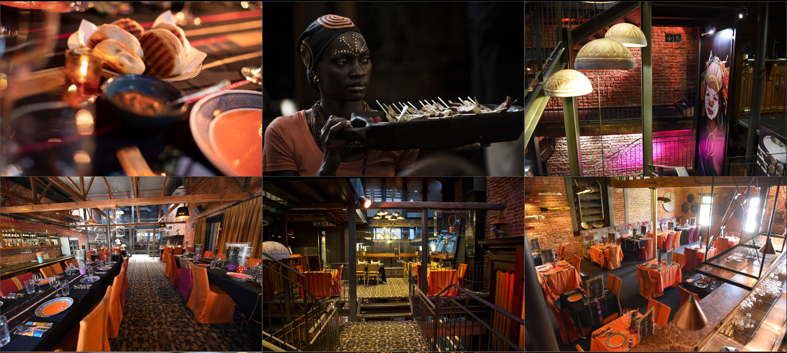
Mama Africa
Hearty, traditional food in colourful, rustic setting with eclectic mix of bands and drummers.
Welcome to our African cuisine restaurant, where we bring the diverse and vibrant flavors of Africa to your plate. Our menu features a range of traditional African dishes, using only the freshest and highest-quality ingredients prepared by our chefs trained in traditional African cooking techniques. But we are more than just a restaurant. We strive to share the beauty and richness of African culture with our customers, from the music to the decor on the walls. Our warm and welcoming atmosphere invites everyone to experience the community and connection that comes with sharing a meal, while discovering the many tastes of Africa.

Marcos African Place
Lively restaurant serving local regional game and international favourites with daily live music.
Marco, chef and owner of Marco's African Place, is the first black restaurateur in Cape Town. In 1989 he opened his first restaurant in Cape Town.
With a mix of traditional and Mediterranean food and live entertainment, Marco's has become a landmark in Cape Town's culinary landscape.

ACCOMMODATION
Cape Town offers a wealth of hotel and accommodation options for visitors to our shores. We have secured block bookings at a selection of excellent hotels within walking distance of the CTICC. These include 3 Star to 5 Star options to cater for all budgets and preferences.
Please note these rates are only valid for the dates of Summit and only when booked through the links provided below. We are unable to assist with any rate changes or amendments on bookings made through third parties or alternative booking engines. Inventory is limited and bookings can not be guaranteed. Please secure your reservation early to avoid disappointment.
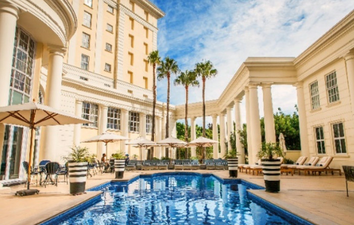
WESTIN CAPE TOWN - 5 Star
Memorable experiences await at The Westin Cape Town, a centrally located 5-star hotel. Enjoy exclusive rooms with unique views over the V&A Waterfront, Table Mountain, and the whole of Table Bay.
Distance: Walking distance to CTICC - 50m
Deluxe Room
Single Occupancy: R 4,500
Double Occupancy: R 4,850
Executive Club Room
Single Occupancy: R 6,000
Double Occupancy: R 6,350
Waterfront Executive Club Room
Single Occupancy: R 6,300
Double Occupancy: R 6,650
Accommodation rates include 15% VAT, breakfast served in Restaurant Thirty7, and mandatory Tourism Levy of 1%.


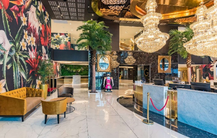
SOUTHERN SUN CULLINAN - 4 Star
Southern Sun, The Cullinan is a premier hospitality destination offering grand hotel accommodation in the heart of Cape Town just moments from the Waterfront.
Distance: Walking distance to CTICC - 250m
Standard Room
Single Occupancy: R 3,650
Double Occupancy: R 3,820
Accommodation rates include 15% VAT and breakfast. Rates exclude the mandatory tourism levy. This amount will be payable when you check-in at the hotel and is equivalent to 1% of your booking total.

SOUTHERN SUN WATERFRONT - 4 Star
Contemporary Comfort in a Great Location. Located in the heart of Cape Town’s most tourist-friendly precinct, the Southern Sun Waterfront hotel invites guests to experience the best of the city, great comfort, excellent amenities, and a warm welcome.
Distance: Walking distance to CTICC - 450m
Standard Room
Single Occupancy: R 3,355
Double Occupancy: R 3,535
Accommodation rates include 15% VAT and breakfast. Rates exclude the mandatory tourism levy. This amount will be payable when you check-in at the hotel and is equivalent to 1% of your booking total.


HOTEL SKY - 3 Star
Say hello to the newest addition to Cape Town’s iconic skyline! Hotel Sky Cape Town is now open at one of the City Bowl’s best addresses, directly opposite the Cape Town International Conference Centre.
Distance: Walking distance to CTICC - 140m
Standard Room
Single Occupancy: R 1,715
Double Occupancy: R 1,920
Accommodation rates include 15% VAT and breakfast. Rates exclude the mandatory tourism levy. This amount will be payable when you check-in at the hotel and is equivalent to 1% of your booking total.

EXHIBITION
The exhibition manual is available here
For any enquiries regarding the exhibition please contact geosummit@presconf.co.za.
Please note that until July 28, organizations which expressed their interest in reserving exhibition space by the May deadline will be given priority for booking exhibition space.
Freighting goods to SA for an exhibition?
Exhibitors and Sponsors can send any boxes through the handeling company Exhibitions Freighting G.S.M.. They should be contacted directly as they will make sure that the goods are delivered to the stands. Please consult following documents:
USEFUL INFORMATION
THE CTICC 2
Against the iconic backdrop of Table Mountain, and a stone’s throw from the Atlantic Ocean, the Cape Town International Convention Centre (CTICC 2) is the perfect venue for an international conference. Located on the Cape Town Foreshore, the venue is easily accessible and in close proximity to many of the city's top hotels, amenities, restaurants and attractions, including the Victoria and Alfred Waterfront.
FACILITIES
Aside from world-class conference and exhibition facilities, the CTICC 2 boasts a variety of visitor facilities, including:
- Parking facilities – P5 is the CTICC 2 visitor parking block (Click here for directions and fees – select P5 tab)
- Wi-Fi
- ATM's
- A business centre
- Prayer facilities
- Onsite medical facilities
ACCESSIBILITY
The CTICC 2 building incorporates international norms as defined by the Americans with Disabilities Act (ADA) and the South African Building Regulations (NBR) Standards. This includes safe and easy building and venue access, lifts and restrooms as well as designated parking bays for the disabled.
GETTING TO THE CTICC 2
Address: Corner of Heerengracht & Rua Bartholomeu Dias, Foreshore, Cape Town, 8001
GPS Co-Ordinates
-33.91747°, 18.42908°
Map
Click here for the CTICC 2 location on Google map

ABOUT SOUTH AFRICA
Geography
South Africa is situated on the Southern tip of the African Continent. It shares neighbouring borders with Namibia, Botswana, Zimbabwe and Mozambique. South Africa encloses both Swaziland and Lesotho. South Africa has over 2700 km of coastline shared between the Atlantic Ocean on the west coast and the warm Indian Ocean on the east coast.
Airports
South Africa's three major international airports are O.R. Tambo International Airport (Johannesburg); Cape Town International Airport; and King Shaka International Airport (Durban).
Weather
South Africa is known for its long sunny days throughout the year. Most of the country experiences rain in summer, however the Cape Town and the Western Cape has predominantly winter rainfall. November is well into summer, so weather should be hot and sunny. Bring a light jersey or jacket in case of a few chilly days or evenings.
People
South Africa is home to a multi-cultural melting pot of 55 million beautiful people of diverse origins, cultures, languages, and religions.
Language
Although English is widely spoken and used for informational signage, South Africa celebrates diversity in language with a total of 11 official languages.
These languages are Afrikaans, isiNdebele, isiXhosa, isiZulu, Sepedi, Sesotho, Setswana, Siswati, Tshivenda, Xitsonga and English.
We recently gained approval for sign language to be recognised as an official language too, bringing our recognition of diverse languages up to 12 - although this process is still underway.
Money
South African Currency
South Africa uses the Rand (ZAR) as currency. Keep in mind that you can only use the Rand to shop, dine and experience the province, so you'll have to exchange your funds for the local currency - luckily this can be done quickly and easily at the airport. Most shopping malls also have a Bureau de Change that will assist you.
Foreign Exchange
As mentioned, you can only pay in Rands in South Africa. However, it is very easy to swap your foreign currency for rands. Money can be exchanged at the airport, as well as commercial banks and Bureaus de Changes, which are easily found in most shopping centres in Cape Town. You may also find exchange facilities in some hotels.
Banking hours are: 9 am - 3.30 pm (weekdays) and 8.30 am – 11 am (Saturdays) and are closed on Sundays and Public Holidays.
Currency Converter:
See how your currency compares to the ZAR here
Cashless Payments
If you don't have any cash on you, no worries. All major credit and debit cards (Visa and Mastercard) are accepted at most establishments in Cape Town, as well as cashless payment methods like Apple Pay and Samsung Wallet. In fact, these are often preferred to cash so if your bank allows it, rather swipe your card than carry cash. It’s safer too.
Water
You may have heard of the Cape Town water crisis and "Day Zero" - the day that taps in the city could potentially have run dry. The drought is thankfully over, but we still treat our water as a scarce and valuable resource. On your visit you'll probably notice water saving tips and initiatives in hotels and restaurants.
Can I drink the tap water in Cape Town?
Yes, it is also perfectly safe to drink tap water in Cape Town – the water is rated as being of a top global standard.
Bottled spring water is readily available at almost any location you visit.
Electricity
The South African electricity supply is 220/230 volts AC 50 HZ. With a few exceptions electricity is available almost everywhere.
Health
South Africa has a well-developed healthcare system. There are both public and private hospitals throughout South Africa. Be sure to top up on medical insurance before leaving home. Well-qualified doctors, dentists, and specialists can be found easily, but it is advisable to make an appointment unless it is an emergency. Standby Medics are available onsite during the Summit.
Do I need to get any vaccinations when travelling to Cape Town?
Yellow fever vaccination certificate required for travellers aged 1 year or over arriving from countries with risk of yellow fever transmission and for travellers having transited for more than 12 hours through an airport of a country with risk of yellow fever transmission.
Is there malaria?
You don't need to worry about malaria tablets, Cape Town is a malaria-free area.